Nicaragua Regions and Provinces Explained
A plain-English map of the 15 departments and two Caribbean regions: who lives where, what each area does and why the line between west and east matters.
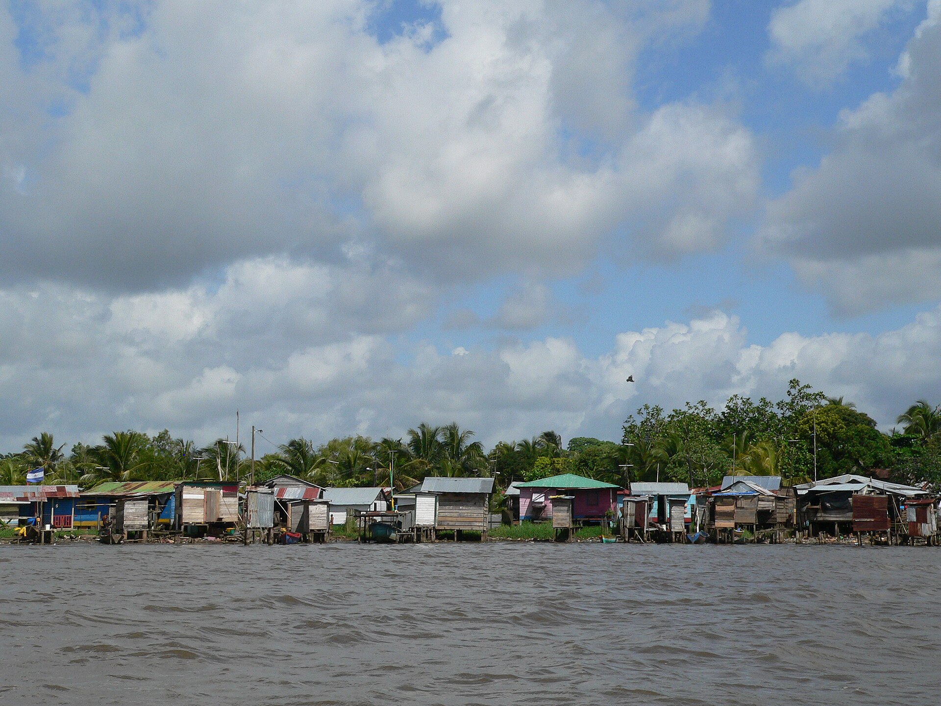
NICARAGUA · REGIONS
Nicaragua is divided into 15 departments (its first-level areas) and two autonomous Caribbean regions, which together contain 153 municipalities. Law 59, the national division law, draws that map, and the national statistics institute (INIDE) uses it in its 2023 yearbook.
For readers in the United States the map shows where Nicaragua’s people and export factories sit, and where they do not. The Caribbean regions cover half the land but hold about one person in seven, so a headline from Managua, the capital, and one from Bluefields, a Caribbean-coast city, describe two very different places.
Key Facts
- Map 15 departments, two autonomous Caribbean regions and 153 municipalities under Law 59.
- People The statistics institute INIDE estimates 6,874,748 residents for 2024; Managua department holds 23.3%.
- Caribbean coast The two autonomous regions cover 50.2% of the land and hold 14.8% of the people.
- Free zones These export-factory parks shipped US$3.78 billion in 2023; four departments sent 77.9%.
- As of 19 November 2026, 20:00 GMT. Population figures are INIDE estimates for 2024.
A plain-English map of the 15 departments and two Caribbean regions: who lives where, what each area does and why the line between west and east matters.
How the Map Is Drawn
The municipality is the basic unit of the map, and departments are groups of municipalities, Law 59 says. Every municipality belongs to one department only, and the law exempts the two autonomous regions from the executive branch’s departmental structure.
Article 6 of the same law divides the national territory into two autonomous regions, 15 departments and 153 municipalities. INIDE’s yearbook lists the same 153, of which 133 sit in departments and 20 in the two regions.
The Caribbean regions run on a second law, the Statute of Autonomy (Law 28), in the consolidated text published in La Gaceta, the official gazette, on 18 August 2016. It names the North Caribbean Coast Autonomous Region, seated in Bilwi (also called Puerto Cabezas), and the South Caribbean Coast Autonomous Region, seated in Bluefields.
Law 59 still uses the older names Atlántico Norte and Atlántico Sur, which is why English-language maps and older reports show different labels. INIDE’s tables use the short forms RACCN and RACCS for the north and south regions.
Each regional council has 45 members chosen by direct vote, and Article 19 of Law 28 requires every ethnic community of the region to be represented. Article 5 makes the languages of the Caribbean communities official in the regions alongside Spanish.
Article 36 defines communal property as the lands, waters and forests that have traditionally belonged to the coast’s communities. It adds that communal land cannot be sold, donated, seized or taxed.
In Plain English
- Department A first-level area made of several municipalities, run by the national government.
- Municipality The basic unit of the map, with its own town hall; Nicaragua has 153.
- Autonomous region A Caribbean-coast area with its own elected council under Law 28.
- Free zone A park where firms make goods for export under a special legal regime.
- Estimate A projected figure; INIDE’s 2024 numbers are estimates, not census counts.
The 15 Departments at a Glance
INIDE’s 2024 estimates put the 15 departments at 5,859,119 people, or 85.2% of the country. The list below gives each department’s capital and population, largest first, using the capitals named in Law 59.
The 15 Departments, Largest First
- Managua (capital: Managua) 1,598,989 people
- Matagalpa (capital: Matagalpa) 619,914 people
- Jinotega (capital: Jinotega) 507,402 people
- Chinandega (capital: Chinandega) 447,684 people
- León (capital: León) 428,723 people
- Masaya (capital: Masaya) 415,170 people
- Nueva Segovia (capital: Ocotal) 286,597 people
- Estelí (capital: Estelí) 234,115 people
- Granada (capital: Granada) 220,874 people
- Carazo (capital: Jinotepe) 202,130 people
- Chontales (capital: Juigalpa) 194,809 people
- Boaco (capital: Boaco) 190,062 people
- Rivas (capital: Rivas) 186,453 people
- Madriz (capital: Somoto) 183,558 people
- Río San Juan (capital: San Carlos) 142,639 people
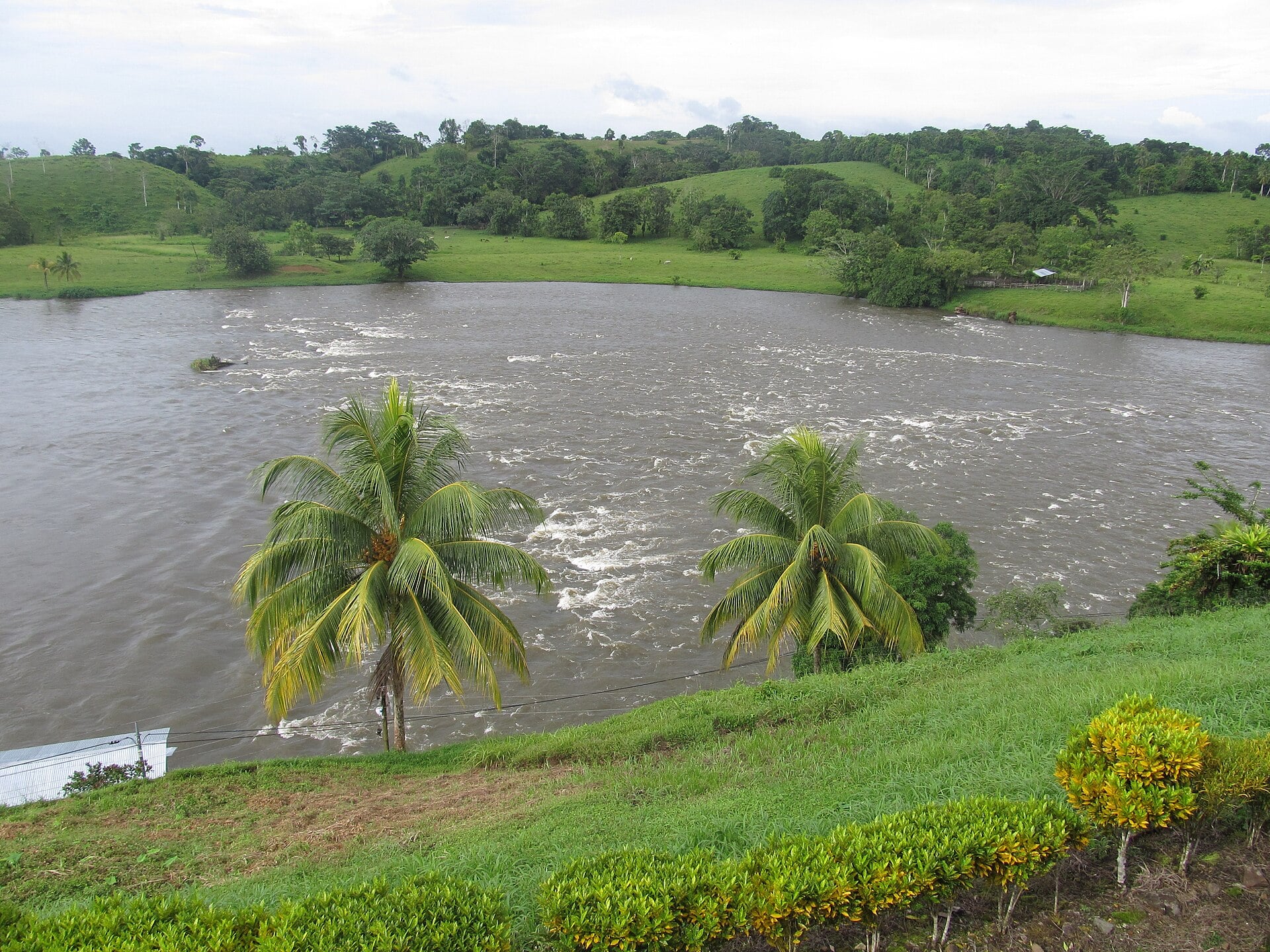
Density varies more than size. Masaya is the smallest department at 610.78 square kilometres, yet it has 679.74 people per square kilometre, while Río San Juan has 18.92, the lowest among the departments.
Managua department has 461.46 people per square kilometre, against a national average of 57.13. The gap shows why one national figure hides so much.
Municipalities, the Real Unit
Because the municipality is the base unit, the numbers below the department matter. Only 12 of the 153 municipalities have 100,000 people or more, while 31 have fewer than 10,000.
Waspán, in the North Caribbean region, is the largest municipality by area at 9,341.71 square kilometres, about 2.7 times the area of Managua department. San Juan de Nicaragua, in Río San Juan department, is the least populated with 2,905 residents on 1,656.75 square kilometres.
Chinandega and Matagalpa have 13 municipalities each, Nueva Segovia has 12 and Granada has just four. That is why department size says little about local government: Granada has four municipal governments for 220,874 people, Matagalpa 13 for 619,914.
Managua, Masaya and the Pacific Core
Managua department is the country’s centre of weight, with 1,598,989 people, or 23.3% of Nicaragua, on 3,465.1 square kilometres. The city of Managua, the national capital, has an estimated 1,066,484 residents, which is 15.5% of the country and 66.7% of its department.
Outside Managua, the largest municipalities are León with 216,108 people, Masaya with 196,798, Matagalpa with 173,412 and Tipitapa, in Managua department, with 162,117. Masaya fits those people into 146.62 square kilometres, a density of 1,342 per square kilometre.
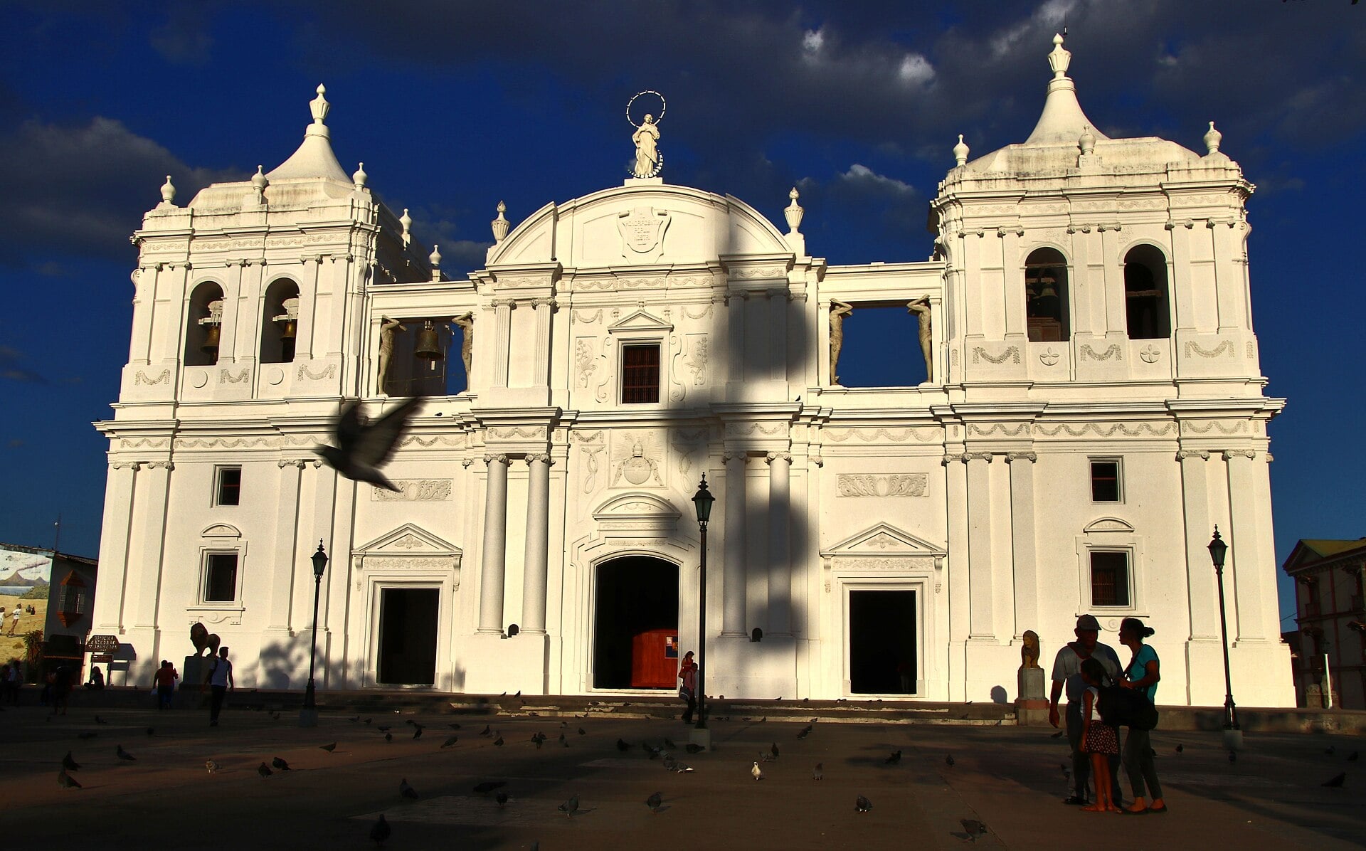
Two large lakes shape the west, according to INETER, the national territorial institute, in INIDE’s yearbook. Lake Cocibolca (Lake Nicaragua) covers 8,138.10 square kilometres including islands and touches Granada, Rivas, Río San Juan, Chontales and Boaco, while Lake Xolotlán (Lake Managua) covers 1,052.90 and touches Managua and León.
The west is also where most free-zone factories sit. Free zones are export-manufacturing parks under a special legal regime, and the national free-zone commission counted 203 firms in 2023, 114 of them in Managua department.
Free-zone exports reached US$3.78 billion in 2023 on preliminary data, and the shares were Managua 29.79%, León 22.10%, Masaya 15.15% and Estelí 10.90%. Estelí, in the north, hosts 42 of the 203 firms, the second-largest count after Managua.
The Two Caribbean Regions
The North Caribbean Coast region (RACCN) has 574,398 people on 33,105.98 square kilometres, and the South Caribbean Coast region (RACCS) has 441,231 on 27,260.02, INIDE’s 2024 estimates show. Together that is 1,015,629 people, or 14.8% of the country, on 50.2% of the land.
That works out to 17.35 and 16.19 people per square kilometre, against 57.13 for the whole country and 461.46 in Managua department. The north region has eight municipalities and the south has twelve.
In the north, Bilwi (Puerto Cabezas), the regional seat, is the largest municipality with 142,268 residents, followed by Siuna with 105,498 and Waslala with 79,092. In the south, Nueva Guinea has the most people at 80,018, ahead of El Tortuguero with 63,657 and El Rama with 59,358, while Bluefields, the regional seat, has 58,958.
Water defines the south. According to INETER data in INIDE’s yearbook, Pearl Lagoon (Laguna de Perlas) covers 505.64 square kilometres and the Bay of Bluefields 172.73, and the Corn Island municipality packs 7,967 people into 9 square kilometres.
The yearbook also shows how little of the coast the free-zone economy touches. The north region has two free-zone firms and no recorded free-zone exports, while the south has four firms and US$66.7 million, or 1.77% of the total.
What the Regions Earn
INIDE’s yearbook, citing the Central Bank of Nicaragua, puts 2023 goods exports outside the free zones at US$4.03 billion, on preliminary data. Gold was the largest line at US$1.13 billion, or 28.0%, followed by meat at US$689 million and coffee at US$607 million, or 15.0%.
Gold shipments were 587,300 troy ounces at an average of US$1,920 per ounce. The yearbook does not assign gold, coffee or meat exports to departments.
Four departments, Jinotega, Boaco, Chontales and Río San Juan, do not appear in the free-zone table at all. Matagalpa, the second-largest department by population, shows one firm and exports of only US$9,520, a sliver beside the US$1.13 billion that Managua department sent in free-zone exports.
Travel Notes for US Readers
Managua is by far the largest city, and the next largest department capitals are León with 216,108 people, Masaya with 196,798 and Matagalpa with 173,412. San Juan del Sur, a Pacific-coast municipality in Rivas department, has 16,123 residents.
The Caribbean regions hold about 17 people per square kilometre, against 57 for the whole country. Bluefields (58,958) and Bilwi (142,268) are the two regional seats.
Read the State Department’s current Nicaragua travel advisory before any trip, together with our guide to entry rules, sanctions and remittances for US visitors. For the people who live in these regions, see our guide to Nicaragua’s population and ethnic groups.
For the wider setting, our explainers cover Nicaragua among its Central American neighbours and the country’s history from the Spanish conquest to 2026. The latest news sits on our Nicaragua news page.
INIDE’s yearbook labels its 2024 figures estimates, and the department results of the 2024 census, which INIDE’s website mentions, are not in it. Until those results appear, every population figure here is an estimate and may change.
Frequently Asked Questions
How many regions does Nicaragua have?
Nicaragua has 15 departments and two autonomous Caribbean regions, which together contain 153 municipalities. Law 59, the division law, sets this map.
What are Nicaragua’s two autonomous regions?
They are the North Caribbean Coast region, seated in Bilwi (Puerto Cabezas), and the South Caribbean Coast region, seated in Bluefields. Each has a 45-member elected council under Law 28.
Which department is the biggest?
Managua is the most populous department, with an estimated 1,598,989 people in 2024, ahead of Matagalpa with 619,914. Granada, the ninth largest, has 220,874 people.
Does Nicaragua have provinces?
No, Nicaragua uses departments, and the Caribbean coast forms two autonomous regions instead. A department is a group of municipalities.
Where are Nicaragua’s export factories?
The free-zone tables show Managua, León, Masaya and Estelí sending most free-zone exports in 2023. The two Caribbean regions together sent 1.77%.
Sources: INIDE, Statistical Yearbook 2023 (tables I.1.1, I.1.3, II.1.4, IV.3.4, V.6.3 and V.6.6; population figures are 2024 estimates); National Assembly, Law 59 on the political-administrative division, as amended (reform approved 21 October 2004, La Gaceta No. 24, 3 February 2005); National Assembly, Law 28, Statute of Autonomy of the Caribbean Coast Regions, consolidated text (La Gaceta No. 155, 18 August 2016) (all accessed 19 November 2026).
This article was produced by The Rio Times’ automated AI newsroom. Editorial responsibility: Matthias Camenzind, Publisher and Editor-in-Chief. The Rio Times also runs Ask Rio Times, which answers from 100,000+ of our own articles, the daily Latin America Power Map, and prediction-market odds on elections and markets.. How we use AI · Report an error
Expat Guide to Nicaragua
What The Rio Times publishes for foreigners who live in or move to Nicaragua.
Start here
- Is Nicaragua Safe for Expats? Crime, Politics and Daily Reality
- Opening a Bank Account in Nicaragua as a Foreigner: Banks, Documents and the Limits
- Moving to Nicaragua: Visas, Costs and Daily Life Under Ortega
- Healthcare in Nicaragua for Expats: Hospitals, Insurance and the Managua Option
Understand Nicaragua