
Explainer: Dominican Republic
Santo Domingo floods because its coastal terraces trap rainwater in low zones, while the sea can block the drains meant to carry that water away. That is the assessment of Martín Meléndez, a civil engineer and hydraulics expert who lectures at INTEC, the Instituto Tecnológico de Santo Domingo, a university in the Dominican capital.
He spoke after the floods of 27 October 2026, which he says showed the vulnerability of several zones despite work by the authorities.
Key Facts
- Why. Low zones trap rain because the land slopes unevenly towards the sea.
- Sewers. An expert estimates only 20% to 30% of the urban area has a formal storm sewer.
- Trigger. Floods on 27 October 2026 exposed weak spots in several zones of the city.
- Fix. He wants a master plan for storm drainage, not only drain cleaning after rain.
- Alerts. The national emergency operations centre (COE) and weather office (ONAMET) issue official warnings.
Coastal terraces, blocked drains and sealed surfaces explain why parts of the Dominican capital flood, according to a hydraulics expert at INTEC.
The Big Picture
INTEC issued a press note on Tuesday 17 November 2026 setting out Meléndez’s analysis of the city’s flooding. His analysis argues that the problem comes from geography, ageing design rules and urban growth, not from one storm alone.
His proposals aim to turn drainage into a long-term plan instead of a clean-up after each rain. More background is in our
Dominican Republic news coverage and our Santo Domingo city guide.
In Plain English
Bathtub effect. Water is trapped in low zones that have too little slope to reach the sea.
Backwater effect. A high sea level submerges drain outlets, so water can pile up or flow back into the streets.
Storm sewer. A pipe network built only to carry rainwater away from streets.
Soakaway well. A pit, called a pozo filtrante in Spanish, that lets rain soak into the ground.
The Bathtub Effect on the Coast
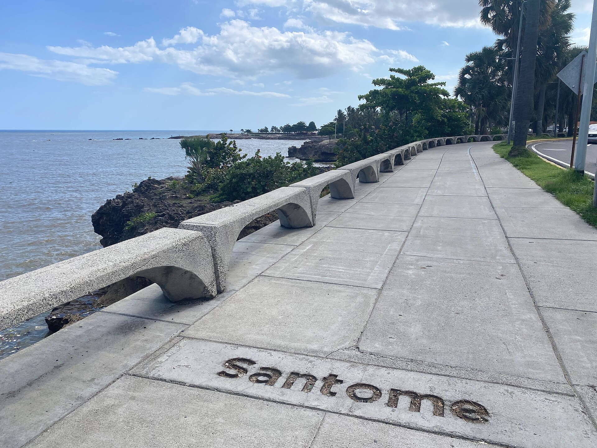
Santo Domingo sits on terraces of coral limestone that do not slope evenly towards the sea. At points such as the Malecón, the seafront boulevard, and the coastal cliffs, the shoreline edge is higher than some roads further north.
One example is Avenida Independencia, a main avenue north of the shore. Meléndez calls the result a bathtub effect, in which water is trapped in low zones with too little slope to reach the sea.
When the Sea Blocks the Drains
Storms and cyclones raise sea level, and storm drains that discharge into the sea can end up submerged. Meléndez calls this the backwater effect.
Without protection, water can pile up or flow back into the streets. The drain then stops removing rain and adds to the problem.
Only a Fraction of the City Has Storm Sewers
Meléndez estimates that only 20% to 30% of the urban area has a formal storm sewer. The other 70% to 80% depends on point solutions such as soakaway wells.
Elsewhere, rain simply runs along streets and avenues. That turns roads into improvised channels.
How Concrete and Rubbish Make It Worse
Existing networks lose capacity when rubbish, plastics and sediment block the inlets, known as imbornales, the grates at the roadside. Part of the infrastructure was also designed with hydrological parameters from the last century, which need updating for intense rain.
Urban growth adds to the load. Roads, car parks and buildings have sealed the surface and reduced natural infiltration, which matters on limestone soils, so more rain runs to low zones.
What the Expert Proposes
Meléndez calls for a Master Plan for Storm Drainage, the Plan Maestro de Drenaje Pluvial, rather than only cleaning drains after each rain. He also proposes large storm collectors and separate sanitary and storm networks.
Other ideas include underground storage tanks, permeable paving, rain gardens, green gutters and infiltration trenches. He also wants a zero hydrological impact rule, so new real-estate projects manage their own rainwater.
What It Means for Visitors and Residents
Travellers and residents should follow official alerts from the Centro de Operaciones de Emergencias (COE), the national emergency operations centre, and from ONAMET, the national weather office. These agencies issue the official warnings for heavy rain.
For ideas on the city this month, see our
November in Santo Domingo page.
What Is Not Known
The 20% to 30% figure is Meléndez’s own estimate, not an official city figure. We did not find an official reply to this specific INTEC assessment.
Rainfall totals for 27 October 2026 are not confirmed here. Damage and casualty figures from that day are not confirmed here either.
Frequently Asked Questions
Why does Santo Domingo flood when it is on the coast?
Meléndez says the coastal terraces slope unevenly, so water collects in low zones. High sea levels in storms can also submerge drains that discharge to the sea.
How much of the city has storm sewers?
Meléndez estimates that 20% to 30% of the urban area has a formal storm sewer. The rest relies on soakaway wells or on rain running along streets, and the figure is his estimate, not an official one.
What does the expert propose?
A Master Plan for Storm Drainage, large collectors, separate sanitary and storm networks, underground tanks and permeable paving. He also wants a zero hydrological impact rule for new real-estate projects.
Sources
INTEC press note of 17 November 2026 (Martín Meléndez, hydraulics expert); Alert bodies named for context: Centro de Operaciones de Emergencias (COE) and Oficina Nacional de Meteorología (ONAMET).
This article was produced by The Rio Times’ automated AI newsroom. Editorial responsibility: Matthias Camenzind, Publisher and Editor-in-Chief. The Rio Times also runs Ask Rio Times, which answers from 100,000+ of our own articles, the daily Latin America Power Map, and prediction-market odds on elections and markets.. How we use AI · Report an error
Living in or visiting Santo Domingo? See this month's events and our Santo Domingo city guide with rents, safety and upcoming concerts.