Congo Is Using Phone Movement Data to Get Ahead of Ebola
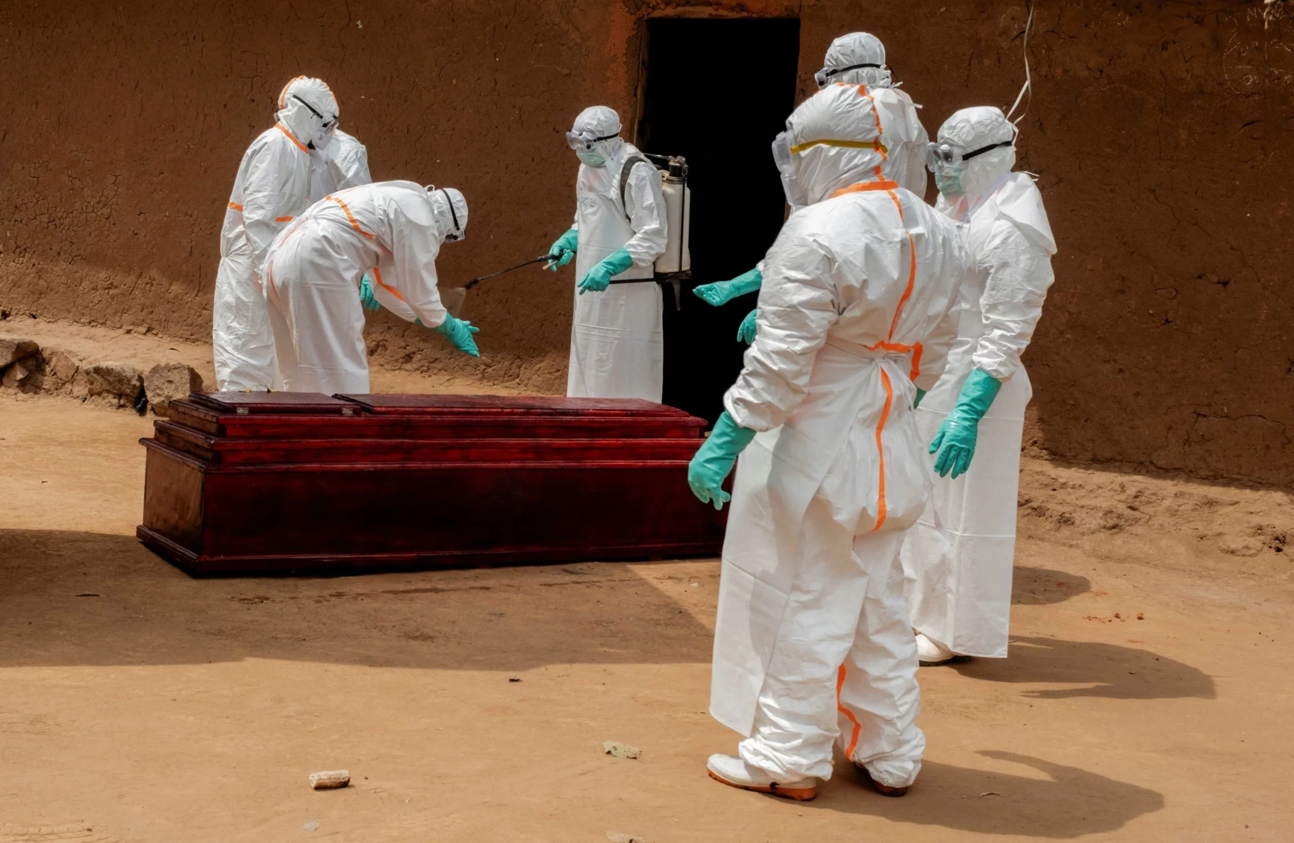
DR CONGO · SCIENCE
Key Facts
- —The method Health officials are using anonymised mobile network records to map where people travel, and therefore where the virus is likely to appear next. The approach has not been used before in an Ebola response.
- —The outbreak More than 6,250 people have been infected and 3,039 have died since the outbreak was declared on 15 May, according to the latest government figures. Cases have been confirmed in six provinces.
- —The strain This is the Bundibugyo species of Ebola, for which there is no approved vaccine or treatment. It is Congo’s seventeenth outbreak and the fastest growing on record, according to the World Health Organization.
- —Who does the analysis The Swedish non-profit Flowminder produces it from aggregated records supplied free of charge by Vodacom, Congo’s largest operator, with more than 26 million active subscriptions.
- —The early test The first analysis tracked people who had been in Bunia, Mongbwalu and Rwampara between 3 and 23 April. By the end of June, all ten of the largest destination areas had confirmed cases.
- —The Kinshasa risk Fifteen of the fifty places most connected to Kisangani are in Kinshasa province. World Health Organization modelling in late June put the probability of a case in the capital by the end of September at 70 percent.
Ebola mobile phone data is being used for the first time to steer an outbreak response, and in Congo it has already worked once. Anonymised records showed that Kisangani was at risk weeks before the first case was found there, and responders moved in early.
How the Ebola mobile phone data works
Every time a handset connects to a network it generates a record of which antenna it reached. Aggregate enough of those records and you can estimate how populations move between districts without ever identifying a person.
That is the raw material Flowminder is working with, supplied at no cost by Vodacom. The non-profit says it receives aggregated and anonymised records only, with no access to information identifying individual subscribers.
The output is not a map of infections. It is a map of connection, which is a different and often more useful thing.
Olivier Le Polain, who heads epidemiology and analytics for response at the World Health Organization’s Health Emergencies Programme, put the value simply: “It gives us a more nuanced understanding of risk.”
Why the old method was not enough
Traditional outbreak risk assessment works outward from the hotspot. You assume the virus is most likely to reach the districts next door, and you push surveillance into them.
That logic breaks in a country where people travel long distances for work and trade. A district three hundred kilometres away that is connected by a road, a river or a mine can be at higher risk than the district immediately adjacent.
Congo is an extreme case of this. It is the size of western Europe with a road network that funnels movement through a small number of corridors.
Mobility data lets responders rank places by how connected they are rather than by how close they are. That is a reordering of priorities, not a refinement of them.
The Ituri mining corridor is the engine
Ituri province in the north-east is where the virus is believed to have started circulating. It is also a place with unusually heavy internal movement.
Le Polain pointed to mining activity and trade as the reason, saying the population movements there are very significant. Artisanal gold mining draws workers in from across the region and sends them home again.
That is the point at which an epidemiology story becomes an economics story. The same informal supply chains that make the province productive also make it a distribution network for a virus.
Rio Times readers will recognise the pattern from Latin America’s own mining frontiers, where informal camps, seasonal labour and porous borders complicate every public health response.
Kisangani was flagged before the first case
The clearest test of the method came in June. Kisangani is a major transport hub on the Congo River, connecting the east of the country to the west, but it does not border the affected areas.
The analysis showed by mid-June that the risk there was significant and that the outbreak could arrive faster than expected. Responders strengthened operations in the city before any case was detected.
That is the whole argument for the technique in one example. Surveillance capacity is finite, and putting it in the right place a fortnight early is worth more than doubling it a fortnight late.
Kisangani has since become part of the vaccination effort, which the government extended to the city in late August.
The road to Kinshasa
More recent analysis has traced the links running west from Kisangani. Fifteen of the fifty areas most connected to it sit in Kinshasa province.
Kinshasa is a city of well over fifteen million people and the country’s main air gateway. A confirmed case there would change the outbreak from a regional emergency into a continental one.
The World Health Organization has been explicit about the risk. Its late-June modelling put the chance of a case being detected in the capital by the end of September at 70 percent.
Settlements along the Congo River and areas near the borders with the Central African Republic and South Sudan have also been highlighted. The river is the road, and it runs in both directions.
What the method cannot see
The analysis currently rests on one operator. Vodacom holds roughly 35 percent of the market, which means the movements of nearly two-thirds of subscribers are invisible to it.
It is also blind at the border. Because it uses Congolese networks, it gives only a partial picture of travel into neighbouring countries, which is precisely where the regional risk lies.
Flowminder and United Nations officials say they are working to add other operators. Each additional agreement widens the sample and sharpens the estimate.
There is a governance question sitting underneath all of this. Aggregated location data is powerful in an emergency, and the safeguards that keep it anonymous are the only thing separating a public health tool from a surveillance one.
Why this matters beyond one outbreak
If the method holds up here it will not stay in Congo. Mobility analysis is cheap relative to the cost of a misplaced response, and every telecom market in the world generates the same records.
For African governments it also raises a commercial question. Vodacom is providing the data free, and the next operator asked may not, which turns an epidemiological input into a negotiation.
Investors watching frontier health systems should take the same lesson. The constraint in this outbreak has been reach rather than science, and reach is a logistics problem with a data layer on top.
The outbreak itself remains grim. More than 3,000 people have died, there is no approved vaccine for this strain, and a better map is not a cure.
Frequently Asked Questions
How is mobile phone data being used against Ebola in Congo?
Anonymised records showing which network antennas handsets connect to are aggregated to estimate how people travel between areas. Responders use that to identify districts at risk before cases appear.
Who provides and analyses the data?
The Swedish non-profit Flowminder produces the analysis using aggregated records supplied free of charge by Vodacom, Congo’s largest operator. Flowminder says it receives no information identifying individual subscribers.
Has the approach worked?
It flagged Kisangani as a significant risk by mid-June, and operations there were strengthened before the first cases were detected. By the end of June, all ten areas receiving the largest travel flows from the original outbreak zone had confirmed cases.
How large is the outbreak?
More than 6,250 people have been infected and 3,039 have died since it was declared on 15 May, according to the latest government data. Cases have been confirmed in six provinces.
What are the limits of the method?
It relies on a single operator holding about 35 percent of the market, so most subscribers are not represented. It also gives only a partial picture of movement across international borders.
Connected Coverage
Our running coverage of this outbreak includes the death toll passing 3,000 and the vaccination push in Kisangani. For the wider picture of how quickly it grew, see why this is the fastest outbreak on record.
Sources: Reuters – Health officials turn to mobile-phone data to track Ebola spread in Congo, 4 September 2026 · Flowminder – Population movements from the Tshopo health zones, 17 July 2026 · WHO – Disease Outbreak News, 29 August 2026 · ECDC – Ebola outbreak in DR Congo and Uganda, 2 September 2026 data
More Africa news: Nigeria | South Africa | Kenya | Egypt | Ghana | Morocco | DR Congo | Angola | Ethiopia | Tanzania
This article was produced by The Rio Times’ automated newsroom system. How we use AI · Report an error · Editorial responsibility: Matthias Camenzind, Editor-in-Chief