Hurricane Polo Nears Mexico’s Baja California Sur, Landfall Due Monday
MEXICO · WEATHER
Key Facts
- —The country Mexico has about 132 million people and a US$1.83 trillion economy (World Bank, 2025), similar in size to Australia’s. Baja California Sur, home to Los Cabos and La Paz, has about 800,000 people.
- —Why it matters The state depends heavily on US and Canadian tourism. In 2014 Hurricane Odile left over 90% of residents without power and shut Los Cabos airport to regular flights for a month.
- —Why now After a week stalling and looping offshore, Polo has turned north toward the peninsula. The US National Hurricane Center (NHC) expects it to reach the coast on Monday as a hurricane.
- —What happened At 2 a.m. Sunday 27 September, Polo was a Category 3 about 300 miles (480 km) southwest of Cabo San Lucas. Mexico then extended hurricane alerts to the eastern shore and Sonora.
- —The numbers Winds of 120 mph (195 km/h); 4–8 inches (100–200 mm) of rain forecast, locally 10. Baja California Sur has 169 shelters for about 33,000 people; Sinaloa has 136 for 53,000.
- —What it means for you Los Cabos and La Paz lie south of the warnings but may get rain and heavy surf. Schools shut Monday and Tuesday; check flights at SJD and LAP.
- —Still open Where Polo makes landfall and how strong it is then. Whether Los Cabos and La Paz airports suspend flights, and whether Sonora’s watch becomes a warning.
Latest — September 27, 2026, 2 a.m. local time (NHC advisory 27)
— Polo is a Category 3 hurricane with 120 mph (195 km/h) winds and a central pressure of 952 millibars. It sat about 300 miles (480 km) southwest of Cabo San Lucas, moving north-northwest at 10 mph (17 km/h).
— Mexico has widened its alerts. Hurricane warnings now cover the west coast from Punta Abreojos to Santa Fe and the east coast from Loreto to Santa Rosalía.
— A hurricane watch now covers mainland Sonora from Huatabampito to Bahía Kino, where hurricane conditions are possible on Tuesday. A tropical storm watch runs south to Topolobampo in Sinaloa.
— Baja California Sur has suspended classes on Monday and Tuesday. Polo’s outer bands flooded streets in Puerto Vallarta on Saturday.
Hurricane Polo is closing on Mexico’s Baja California peninsula after a week of stalling and looping in the Pacific. Forecasters expect it to reach the coast of Baja California Sur on Monday, 28 September, still as a hurricane.
At 2 a.m. local time on Sunday, the US National Hurricane Center (NHC) put Polo’s sustained winds at 120 mph (195 km/h). That makes it a Category 3, the lowest “major” rating on the five-step Saffir-Simpson scale.
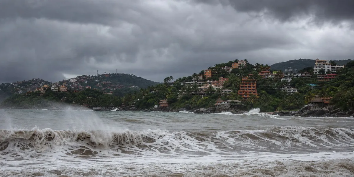
What changed overnight
Polo held its strength through Saturday night. Its central pressure edged up from 950 to 952 millibars; a lower number means a stronger storm.
The storm is now moving north-northwest at 10 mph (17 km/h). The NHC expects a turn north later on Sunday, then northeast on Monday, toward the peninsula.
Early on Sunday, Mexico’s government issued new alerts. The biggest change is a hurricane warning for the peninsula’s eastern shore, on the Gulf of California, from Loreto to Santa Rosalía.
It also put the mainland on notice. A hurricane watch now covers the Sonora coast from Huatabampito to Bahía Kino, a stretch that includes the port of Guaymas.
Warnings now in force
A hurricane warning means hurricane conditions are expected, typically within 36 hours. A watch means they are possible, typically within 48 hours.
Hurricane warnings cover the west coast of Baja California Sur from Punta Abreojos to Santa Fe. They also cover the east coast from Loreto to Santa Rosalía, including Mulegé.
Hurricane watches cover the rest of the east coast, from San Evaristo to Bahía San Juan Bautista. Watches also run up the west coast to Punta Eugenia, and tropical storm warnings apply along all of them.
On the mainland, the Sonora coast from Huatabampito to Bahía Kino is under a hurricane watch. A tropical storm watch runs south from Huatabampito to Topolobampo, in northern Sinaloa state.
Los Cabos and La Paz, the two main centres for foreign residents, lie south of every warning and watch. Later advisories can extend them.
Track and timing
On the NHC track, tropical storm conditions could reach the south of the warning zone by late Sunday. Hurricane conditions follow on the west coast by Monday afternoon.
Polo then crosses the peninsula on Monday night. It approaches the Sonora coast early on Tuesday, 29 September, where hurricane conditions are possible.
The NHC forecast keeps winds near 105 mph (165 km/h), a Category 2, about six hours before landfall. Stronger wind shear and land should then weaken it rapidly.
Forecasters call the mainland landfall harder to judge, and one model keeps Polo a hurricane there. Private forecaster AccuWeather also projects about Category 2 strength at the Baja landfall.
Rain, surge and surf
The NHC forecasts 4 to 8 inches (100–200 mm) of rain across parts of Baja California Sur, locally 10 inches (250 mm). On steep desert terrain, that can cause life-threatening flash floods and mudslides.
A storm surge could flood coasts where the wind blows onshore, with large and destructive waves. Swells will bring dangerous surf and rip currents for the next few days.
Moisture from Polo and another storm, Odalys, may also raise flash-flood risk in the southwestern United States this week, the NHC says.
How Mexico is preparing
Baja California Sur has suspended classes on Monday and Tuesday. It has 169 temporary shelters on standby, with room for about 33,000 people.
Ports in Los Cabos and Comondú are closed, along with 26 beaches in Los Cabos. Sinaloa has readied 136 shelters for more than 53,000 people, state officials say.
The federal power utility, the Comisión Federal de Electricidad (CFE), has crews on standby in Sonora, Sinaloa and Baja California Sur. In 2014, Hurricane Odile left over 90% of the state without power.
Ports and schools on the southwestern coast shut earlier in the week, while Polo stalled offshore. See Category 5 Hurricane Polo Stalls off Mexico as Ports and Schools Shut.
Far to the southeast, Polo’s outer bands flooded several Puerto Vallarta streets on Saturday, including Avenida México and Las Glorias. Beaches there and in neighbouring Bahía de Banderas flew red flags.
A Saturday afternoon storm left some Viva Aerobús and Volaris flights waiting on the ground at Puerto Vallarta airport. The airport operator, GAP, reported no wider disruption.
What expats and travellers should know
Los Cabos (Cabo San Lucas and San José del Cabo), La Paz and Todos Santos host large American and Canadian communities.
The US Embassy in Mexico has issued weather alerts on Polo since 23 September. They urge US citizens in the affected states to follow local media and civil protection instructions.
Follow Mexico’s national weather service, the Servicio Meteorológico Nacional (SMN), and state civil protection channels. Stay off beaches and coastal roads, and secure anything loose outdoors.
Keep phones charged and documents together. Confirm flights with your airline before heading to Los Cabos (SJD) or La Paz (LAP) airports on Monday or Tuesday.
NHC advisory times use Mountain Standard Time, the local time in Baja California Sur. That is one hour behind Mexico City.
What comes next
The NHC issues a full advisory on Hurricane Polo every six hours, with updates in between. The next complete one is due at 8 a.m. local time on Sunday.
Watch whether warnings extend south toward La Paz or Los Cabos, and whether the Sonora watch becomes a warning.
A Category 3 rating today does not mean a Category 3 landfall. Nor does sitting outside the warnings mean Los Cabos escapes rain, surf or flight disruption.
A weaker storm can still be deadly. The NHC’s main inland warning is about flooding rain and mudslides, not wind.
What We Could Not Confirm
- The exact landfall point and Polo’s strength at landfall. The NHC and AccuWeather both point to about Category 2, but the NHC calls its later forecast low-confidence.
- Whether Los Cabos (SJD) and La Paz (LAP) airports will suspend operations on Monday. No closure had been announced by early Sunday.
- Whether hotels in the warning zone will move guests to shelters. No general evacuation order for tourists had been announced.
Frequently Asked Questions
When will Hurricane Polo make landfall in Mexico?
The NHC expects Polo to reach the west coast of Baja California Sur on Monday, 28 September. Hurricane conditions arrive by Monday afternoon, and Polo approaches Sonora early on Tuesday.
Are Los Cabos and La Paz under a hurricane warning?
No: as of 2 a.m. on Sunday, warnings run from Punta Abreojos to Santa Fe and from Loreto to Santa Rosalía. Both cities lie further south but may still get rain and dangerous surf.
How strong will Polo be at landfall?
Polo is a Category 3 with 120 mph (195 km/h) winds. The NHC forecasts gradual weakening to about 105 mph (165 km/h), a Category 2, shortly before landfall on Monday.
How much rain is coming?
The NHC forecasts 4 to 8 inches (100 to 200 mm) across parts of Baja California Sur, locally 10 inches (250 mm). It warns of life-threatening flooding and mudslides, especially on steep terrain.
Is Puerto Vallarta affected by Polo?
Only indirectly: outer rain bands flooded several streets and held some flights on the ground on Saturday, 26 September. There are no hurricane or tropical storm alerts for that coast.
Sources: US National Hurricane Center, public advisory 27 on Hurricane Polo, NHC forecast discussion 27, NHC advisory archive for Polo, NHC tropical cyclone report on Hurricane Odile (2014), Meganoticias on Sinaloa’s shelters, The Straits Times citing AccuWeather, Quadratín Jalisco on Puerto Vallarta flooding, Tribuna de la Bahía on airport delays, EFE via ABC Noticias on port and beach closures, El Independiente on BCS shelters and school closures, World Bank, World Development Indicators (Mexico population and GDP, 2025); INEGI, 2020 census
This article was produced by The Rio Times’ automated newsroom system. How we use AI · Report an error
Read More from The Rio Times