Clandestine Airstrips: Colombian Intelligence Maps 93 ELN Runways Inside Venezuela
SECURITY · COLOMBIA
Latest — 1 October 2026. The mapped build-up has turned deadly: on Monday, Venezuela’s Bolivarian National Guard and presumed ELN fighters clashed in Junín, Táchira — one of the two states named in the airstrip reporting — leaving one dead and at least five injured, the NGO Fundaredes told AFP. It is the first confrontation between Venezuelan security forces and the ELN since President De la Espriella took office in August. Full story: what the Junín clash means for the border.
Key Facts
- —The country Colombia, where the ELN (National Liberation Army), the country’s largest remaining guerrilla group, operates on both sides of the roughly 2,200-kilometre border with Venezuela.
- —What happened Late on 30 September 2026 El Tiempo reported that Colombian intelligence has identified 93 irregular airstrips used by the ELN inside Venezuela, up from about 15 points tracked in early 2026.
- —Who is involved The ELN’s Northeastern War Front, linked to commander Luz Amanda Payares (alias Silvana Guerrero), in Venezuela’s Zulia and Táchira states, according to the same reports.
- —What it means for you The US State Department, in a 29 September alert, told its citizens not to travel to Norte de Santander or within 10 km of the Venezuelan border.
- —Still open No Colombian agency has put its name to the figure. The reports carried no public comment from Bogotá or Caracas as of 1 October.
Colombian intelligence has mapped 93 clandestine airstrips used by the ELN guerrilla inside Venezuela. The Bogotá newspaper El Tiempo reported the figure late on 30 September 2026. At the start of the year, the same monitoring tracked only about 15 such points.
The ELN, or National Liberation Army, is Colombia’s largest remaining rebel group and is classed by Washington as a terrorist organisation. The report adds that some of its camps now sit inside or beside Venezuelan towns, not only in remote forest.

What the intelligence map shows
El Tiempo did not name the agency behind the map, describing the source only as Colombian intelligence work using drones and other devices. Infobae and El País of Cali carried the same figures, both crediting El Tiempo.
The reports give exact dimensions for four runways in Zulia state, near Lake Maracaibo. The longest, at Casa de Hierro in Jesús María Semprún municipality, measures 2,300 by 30 metres.
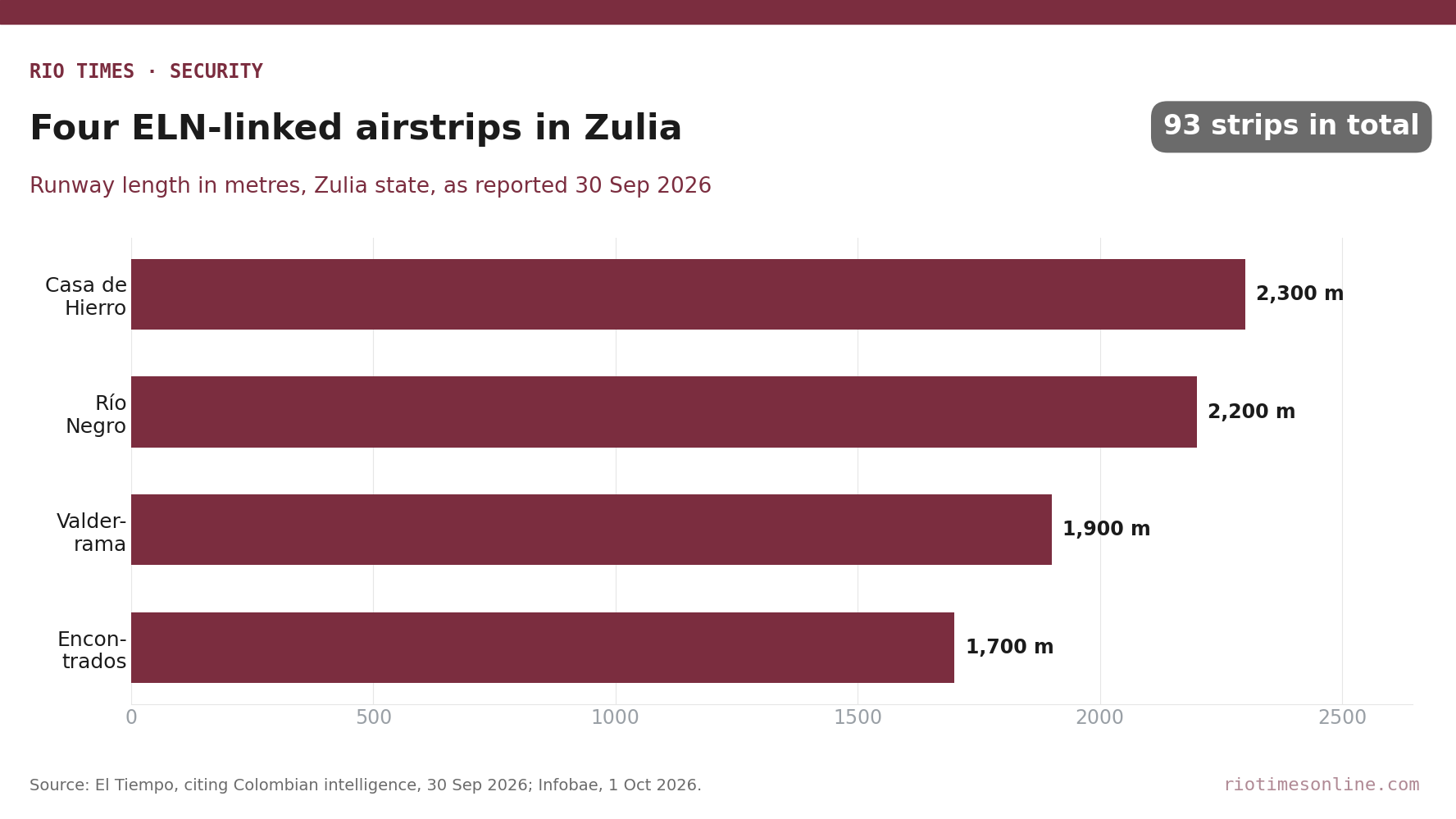
A strip of that length can take light twin-engine aircraft of the kind often used for cocaine flights. The other three measure between 1,700 and 2,200 metres, at Río Negro, Valderrama and the outskirts of Encontrados.
Camps move closer to towns
The second finding is a shift in where the guerrilla sleeps. Camps have been located at Encontrados, El Cruce and Casigua El Cubo, all in Zulia, some within or next to populated centres.
The reports do not say why, but camps beside homes are harder to strike without risking civilians. The Serranía del Perijá, a mountain range linking Zulia with La Guajira and Norte de Santander, is described as the main corridor.
Why the border region is under strain
The map follows a 29 September security alert from the US State Department. It warned that the ELN and other groups in Catatumbo have repeatedly used explosive-laden commercial drones against police and army posts.
That pattern was visible in the attack described in Drones Drop Nine Grenades on Colombian Police Station in El Carmen. Travel advice for the region is collected in How to Stay Safe in Colombia in 2026: Advisories, Dating-App Risks and Regions to Avoid.
The map measures capacity, not traffic. It records where runways exist, not how many flights use them or what they carry.
In January, Cambio magazine reported that foreign intelligence agencies had located ten ELN camps near Lake Maracaibo. The new figures suggest that network has grown, if the count holds.
What Is Not Yet Known
No Colombian agency has publicly confirmed the 93 figure, and it rests on a single newspaper’s access to intelligence material. It is also unclear how many of the clandestine airstrips are active rather than abandoned.
No response from the Venezuelan government appeared in the reports by Thursday afternoon. Whether Bogotá will raise the findings with Caracas remains open.
Sources: El Tiempo (30 Sep 2026); Infobae (1 Oct 2026); El País, Cali (1 Oct 2026); Infobae on the US State Department alert (30 Sep 2026); Cambio (7 Jan 2026).
Read More from The Rio Times