Peru · EARTHQUAKE
Key Facts
- —What happened A magnitude 7.2 earthquake struck southern Peru near Coracora on 20 August 2026.
- —How big a jump The tremor was felt as far away as Lima, 500 kilometres from the epicentre.
- —The catch The USGS measured the same quake at 6.7, leaving two official magnitudes in use.
- —What it means Deep quakes travel far, but no deaths or tsunami risk have been reported so far.
- —Where it hit Damage was reported in Ayacucho and parts of Cusco, with a power cut in Nazca.
- —What comes next Authorities are assessing damage and monitoring aftershocks, though those so far were imperceptible.
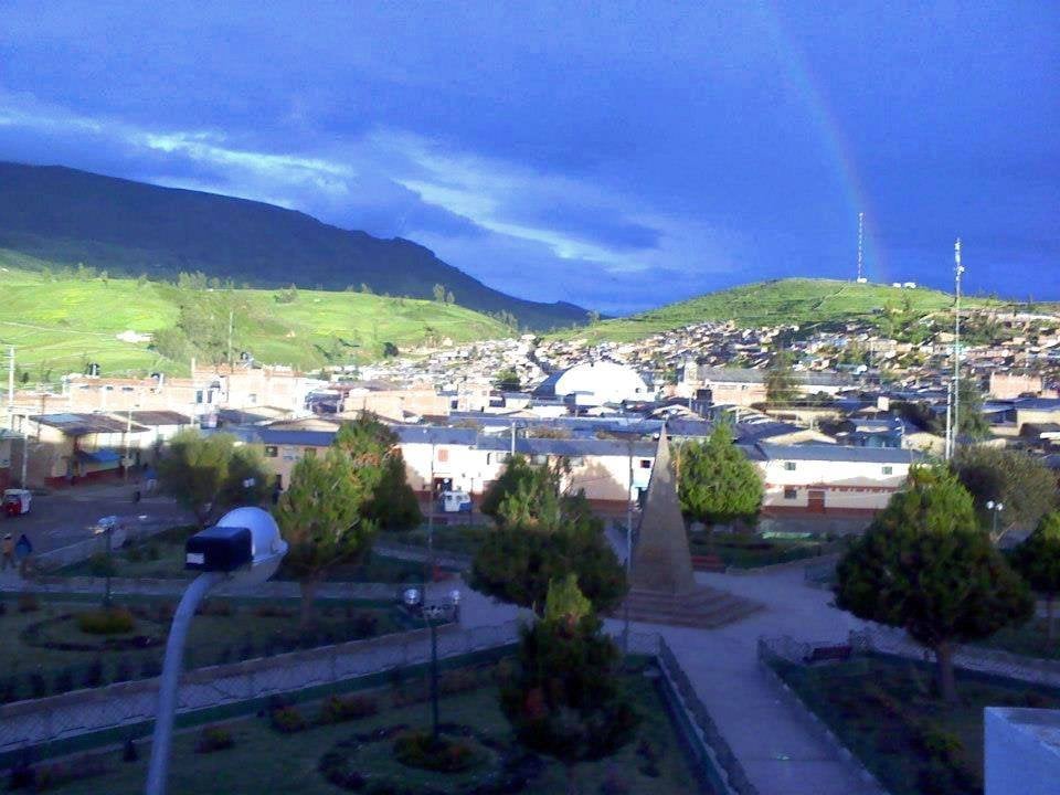
The strong tremor, centred near Coracora, was felt as far away as Lima, prompting emergency checks across southern Peru.
The Ayacucho earthquake struck southern Peru on Thursday 20 August 2026, at 13:00:16 local time. The Instituto Geofísico del Peru, the IGP, put its magnitude at 7.2.
The magnitude 7.2 tremor was felt as far away as Lima.
A Strong Shake in Southern Peru
The Ayacucho earthquake hit the Ayacucho region of southern Peru on Thursday 20 August 2026 at 13:00:16 local time. The Instituto Geofísico del Peru (IGP) reported a magnitude of 7.2.
Meanwhile, the United States Geological Survey (USGS) measured the same quake at magnitude 6.7. Both figures are in use, as reported by EFE and El Comercio.
Epicentre Near Coracora
The epicentre was about 35 kilometres north of the town of Coracora, in Parinacochas province, Ayacucho region. Coordinates given by El Comercio place it at latitude -14.70, longitude -73.78.
The IGP put the depth at 108 kilometres, while the USGS measured 66.7 kilometres. This depth difference explains why the quake was felt over a wide area.
Felt in Lima
The quake was felt as far away as Lima, the capital, according to El Constitucional. This is because deep earthquakes can travel long distances.
In fact, the shaking reached the capital, far to the north-west of the epicentre.
What the Ayacucho Earthquake Damaged
Indeci, Peru’s civil defence agency, reported structural damage to homes, schools and health centres. The damage covered Ayacucho and parts of Cusco.
This was reported by Exitosa and a live Indeci briefing carried by La Republica. El Comercio reported that Indeci’s first damage report listed affected buildings, people injured, and a power cut in Nazca.
However, no specific counts were given.
No Deaths Reported
No deaths were reported, according to TeleSUR and the Indeci chief’s briefing on 20 August 2026. This is a relief for the region.
Still, injuries were reported, and authorities are assessing the full impact. The focus remains on ensuring safety and providing aid.
Aftershocks and Monitoring
Around ten aftershocks followed, all of very small magnitude and imperceptible to the population, according to Asismet, reported by Infobae. This is a positive sign after such a strong quake.
Therefore, the immediate danger of large aftershocks seems low. However, monitoring continues to ensure no new threats emerge.
No Tsunami Threat
Chile’s naval hydrographic service, SHOA, located the quake 167 kilometres north-east of Chala in Peru. It said the quake did not meet the conditions to generate a tsunami on the Chilean coast.
This was reported by Puranoticia and La Hora. As a result, coastal residents in Chile can rest easy.
The quake’s depth and location did not pose a tsunami risk.
Emergency Response Activated
Peruvian authorities activated emergency monitoring and damage assessment, according to TeleSUR, Exitosa, and La Republica. This is a standard response to such events.
In addition, President Keiko Fujimori, in office since 28 July 2026, is likely overseeing the response. The government is coordinating with Indeci to assess needs.
What the Ayacucho Earthquake Leaves Behind
The Ayacucho earthquake serves as a reminder of Peru’s seismic activity. The country sits on the Pacific Ring of Fire, making quakes common.
In short, the immediate focus is on recovery and safety. Authorities will continue to monitor the situation and provide updates as needed.
More: Peru news in English, every day from The Rio Times.
The big picture: Peru explained — economy, politics, society and daily life in one read.
What was the magnitude of the Ayacucho earthquake?
The Instituto Geofísico del Peru (IGP) reported a magnitude of 7.2. The United States Geological Survey (USGS) measured it at 6.7, so both figures are in use.
Where was the epicentre of the Ayacucho earthquake?
The epicentre was about 35 kilometres north of the town of Coracora, in Parinacochas province, Ayacucho region. The coordinates are latitude -14.70, longitude -73.78.
Was the Ayacucho earthquake felt in Lima?
Yes, the quake was felt as far away as Lima, according to El Constitucional. This is because the earthquake was relatively deep, allowing seismic waves to travel far.
Did the Ayacucho earthquake cause a tsunami?
No, Chile’s naval hydrographic service SHOA said the quake did not meet the conditions to generate a tsunami on the Chilean coast. The quake was located 167 kilometres north-east of Chala in Peru.
Connected Coverage
Sources: EFE; El Comercio; Infobae; TeleSUR; Exitosa.
Frequently Asked Questions
This article was produced by The Rio Times’ automated newsroom system. How we use AI · Report an error · Editorial responsibility: Matthias Camenzind, Editor-in-Chief