Rio de Janeiro Weather Shuts Schools; 2 Nations on Alert
Brazil · Uruguay · Weather
Key Facts
—The system. A rapidly intensifying extratropical cyclone over the South Atlantic and its associated cold front are driving strong winds from Uruguay to southeastern Brazil.
—Uruguay’s red alert. Authorities restricted mobility along the eastern coastal strip from 9 p.m. Thursday to 4 a.m. Friday as gusts were forecast to exceed 120 km/h.
—Rio’s warning. Rio de Janeiro entered Stage 2 at 7:05 p.m. Thursday; state officials warned of winds above 90 km/h in the metropolitan area and 91–110 km/h elsewhere.
—School closures. Municipal and state public schools in Rio suspended Friday classes, as did Faetec; Paraty and Angra dos Reis also halted municipal classes.
—Observed versus forecast. Rio recorded gusts up to 54.6 km/h early Friday, below the peak forecast; the strongest period was expected later in the day.
—The next phase. Rio expects winds to ease Friday night, while coastal and infrastructure risks remain subject to official updates as the front advances.
A powerful South Atlantic weather system has forced two of South America’s most exposed coastal regions into emergency mode. Uruguay imposed a red alert and temporary mobility restrictions along its eastern shore overnight, while Rio de Janeiro suspended public-school classes before the strongest forecast winds arrived on Friday.
The measures show how the same broad system is producing different risks over time and distance. Uruguay faced the cyclone’s most intense coastal wind window first. Farther north, Rio prepared for a later surge of damaging gusts, falling trees, power disruption and difficult travel as the associated cold front moved toward southeastern Brazil.
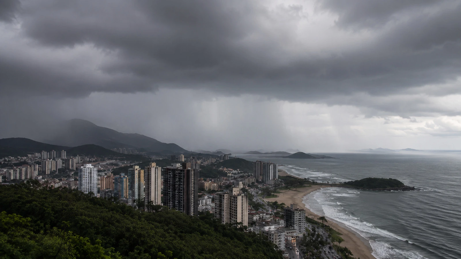
One System, Two Emergency Responses
Uruguay’s National Emergency System said the extratropical cyclone could generate gusts above 120 km/h from the Pando stream eastward to Aguas Dulces. The zone covers much of the coast through Canelones, Maldonado and Rocha, including the wider Punta del Este area. Authorities also warned of a significant rise in coastal waves.
The red alert ran from 9 p.m. on August 6 until 4 a.m. on August 7. It restricted mobility and suspended risk-related public activities, while essential state services remained active. The government urged private organizations to follow the same precautionary standard. The fixed seven-hour window was not an all-day shutdown; it targeted the period of greatest expected intensity.
In Rio, the operational response was longer and more preventive. The city entered Stage 2, the second level on a five-stage scale, at 7:05 p.m. Thursday. That classification means high-impact incidents are possible, even if the city has not yet recorded a generalized emergency.
Rio Closes Schools Before the Strongest Winds
Rio’s municipal and state public-school networks canceled Friday classes, and the Faetec technical-school system also suspended activities. Paraty and Angra dos Reis made the same decision for municipal schools. Officials described the closures as a way to reduce travel by students, families and education workers during the risk period.
The state Civil Defense warned that gusts could exceed 90 km/h in metropolitan Rio. Forecasts for the Serra Fluminense, southern Rio state and the Costa Verde ranged from 91 km/h to 110 km/h. Within the capital, Alerta Rio described Friday gusts as strong, at 52–76 km/h, to very strong, above 76 km/h.
Early measurements were lower than the day’s maximum forecast. The strongest reported gust during the early morning reached 54.6 km/h, according to figures cited by Exame from city monitoring. That gap matters: a forecast ceiling is not an observed speed, and the closures were ordered before the anticipated afternoon peak.
An orange coastal-wind notice also covered sections of Rio state’s shoreline, including Cabo Frio, Arraial do Cabo, Búzios and Campos dos Goytacazes. Authorities highlighted the risk of moving dunes, falling branches and damage to exposed structures.
Uruguay Used Its Highest Alert Level
Uruguay’s decision went beyond a meteorological warning. By declaring a red alert, the executive activated emergency operations and attached legal restrictions to the forecast. The measure covered named communities in Maldonado and Rocha as well as surrounding areas along the eastern coastal strip.
Officials advised residents to remain indoors, avoid unnecessary travel and stay away from the exposed coastline. They also urged people to secure loose objects and prepare for falling trees, signs and power lines. The notice emphasized wave action as well as wind, making beaches, ports and waterfront roads especially vulnerable.
The official alert described what could occur, not a confirmed damage total. Any assessment of outages, structural losses or injuries should therefore rely on later emergency reports rather than on the forecast itself.
Why This Matters for the Southern Cone
The episode demonstrates the cross-border reach of South Atlantic cyclones. The center of the low does not need to pass directly over every affected city. Its pressure gradient, fronts and coastal circulation can produce dangerous winds hundreds of kilometers away and at different hours.
That creates a coordination problem for governments, transport operators and power companies. Uruguay used a narrow overnight restriction for its most exposed coast. Rio reduced daytime movement through school closures and raised its operational readiness. Both responses were tailored to local timing rather than to a single regional warning window.
For residents and travelers, the practical risk extends beyond rain. Strong crosswinds can disrupt bridges and airports; falling trees can block roads and cut electricity; high waves can affect ports and coastal recreation even after inland winds start to ease.
What to Watch Next
- Whether observed gusts in Rio approach the 90–110 km/h forecast range outside the capital.
- Official reports of power outages, fallen trees, transport interruptions or injuries in Rio state and Uruguay.
- Any extension or replacement of Uruguay’s expired red-alert window.
- Rio’s operational-stage decision after winds ease and the front moves through.
- Coastal-wave and marine warnings through the weekend.
Connected Coverage
- Brazil Bomb Cyclone: Red Alert for Rio Grande do Sul
- Weather in Rio de Janeiro: A Month-by-Month 2026 Guide
More: Brazil news, every day from The Rio Times.
Frequently Asked Questions
Were winds of 110 km/h already recorded in Rio?
Not in the early-morning figures cited here. The 91–110 km/h range was a forecast for parts of Rio state; the strongest early gust reported in the capital was 54.6 km/h.
Was Punta del Este under Uruguay’s red alert?
The official alert covered the eastern coastal strip from the Pando stream to Aguas Dulces, including areas of Maldonado Department around Punta del Este.
Why were Rio’s schools closed?
Officials said the preventive closure would reduce travel and exposure for students, families and staff during the period of strongest expected winds.
What does Stage 2 mean in Rio?
It is the second level of Rio’s five-stage operating system and indicates a risk of high-impact incidents, with the possibility of a further change if conditions worsen.
When did Uruguay’s red alert end?
The declared window ended at 4 a.m. on Friday, August 7. Later conditions remain subject to fresh notices from SINAE and INUMET.
Sources
- Rio Operations and Resilience Center — Stage 2 notice
- Uruguay National Emergency System — red alert declaration
- Uruguayan Institute of Meteorology — current warnings
- Exame — Rio closures and state wind forecast
This article was produced by The Rio Times’ automated newsroom system. How we use AI · Report an error
Read More from The Rio Times