Rio Rainfall Caused by South Atlantic Convergence Zone, May Last 11 Days
RIO DE JANEIRO, BRAZIL – The heavy downpours that have affected Rio de Janeiro and Baixada Fluminense since Saturday night were caused by the South Atlantic Convergence Zone (SACZ).
According to the Center for Weather Forecasting and Climate Studies of the National Institute for Space Research (INPE), the cold front blocked by the Southeast was fed by the humidity coming from the Amazon in altitude, building a large corridor of heavy clouds.
When the SACZ is formed, it is a signal of heavy rainfall, which causes overflows and flooding and means that there will be several days of persistent and heavy rains.

Mud on the mayor: Crivella blames population for floods and is hit by mud thrown by residents.
The INPE’s meteorologist Maicon Veder explains that the instability in Rio and the Metropolitan Region may last up to 11 days. This weather system is characteristic of this time of year, that is, in summer, which strongly influences the weather and climate and is typified by an interaction between meteorological events of medium and tropical latitudes.
“The damage is typical for this time of year, and we have had similar events in rainy decades. This occurs due to the SACZ which is a system that modulates the rainy season in the Southeast and Midwest, which is only formed with at least three rainy days.
Generally, it has lasted from four to five days, but can reach up to 11 days in Rio,” says the meteorologist.
The forecast is that the weather will improve midweek, but it should rain again over the weekend. According to Climatempo, on Tuesday, March 3rd, the sun may even show up at times, but the formation of a low-pressure area at sea, near the coast of the state of Rio de Janeiro, will keep the risk of rainfall high which may still be moderate to heavy.
Between Wednesday and Friday, March 4th and 6th, the whole state will remain heavily cloudy and despite the chance of sunny periods, rainfall may occur at any time and there are conditions for moderate to heavy downpours, with lightning and powerful wind gusts.
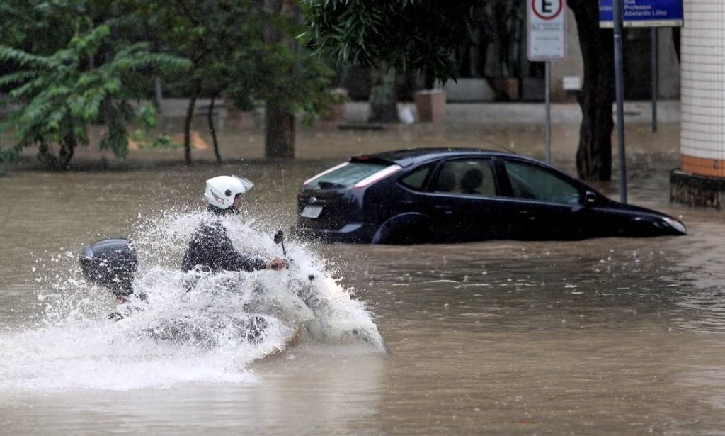
Influence of sea water temperature
Unlike previous years, there is no “El Niño” or “La Niña” in 2020 interfering with the summer rainfall in southeastern Brazil. According to Climatempo meteorologist Joselia Pegorim, the sea temperature in the South Atlantic Ocean, near the coast of the Southeast Region, has a greater influence on rainfall behavior as it is below average.
“This is interfering with the wind flow over Brazil at several levels of the atmosphere. The cold water on the Southeast coast is helping the convergence of winds over the interior of this region. Warm and humid winds from the North of Brazil and also humid winds from the sea meet over the Southeast Region.
Since the beginning of summer, we have experienced several weeks in which this wind convergence has been quite pronounced, leading to more intense and persistent rainfall areas over the Southeast Region,” explains Josélia.
However, according to the meteorologist, there was an aggravating factor during the month of February 2020: the most intense portion of this concentration of humidity spread over the region that covers the city of Rio, helping the incidence of rain.
Warning for the next 36 hours
Rio de Janeiro and the Metropolitan Region will remain on alert until the next 36 hours. The accumulated rainfall may reach 30 to 50 millimeters over a period of one hour, but the amount within the next 24 hours may exceed 100 millimeters. The National Institute of Meteorology has put up a red warning for heavier rainfall.
“We had the arrival of a cold front, which passed through Rio de Janeiro and was close to Espírito Santo on Thursday. There was a low pressure system in the state, as well as in the Minas Gerais triangle and the Northern Coast of São Paulo, intensifying the rain in these areas.
The situation persists because the low pressure formation persists, with a forecast of heavier rainfall over the next 24, 36 hours,” explains meteorologist Marlene Leal.
Last Monday until dawn on Tuesday, the forecast is for the largest accumulated rainfall in the Metropolitan Region and Baixada Fluminense, which will still reach Quissamã, a part of the Lake District, as well as Cabo Frio, in the Serrana Region, Northwest and South of the State.
“This warning of heavy rainfall was up from Friday in Rio. The trend is for an improvement during the week, but by the end of the week it should rain again,” says Marlene.
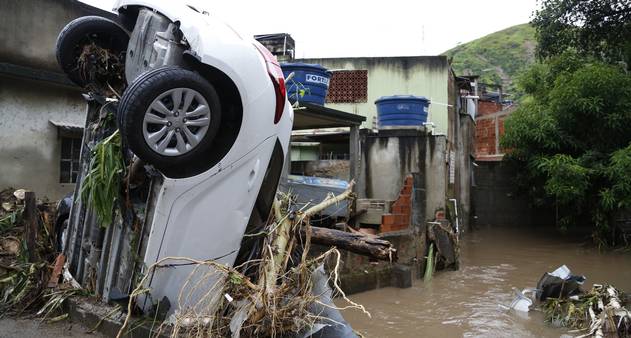
Six hundred and forty-four calls
The Undersecretary of Protection and Civil Defense, under the Municipal Secretariat of Public Order (SEOP), reported having received 604 calls from 8:30 PM on Saturday to 8:00 PM on Monday, the majority of which due to collapse of structures, danger of structures collapsing, land and slope slides and buildings with cracks and infiltrations.
The neighborhoods in greatest demand are: Realengo (105 occurrences), Taquara (54), Campo Grande (39), Bangu (31), Deodoro (21) and Tijuca (21).
At 1:28 PM on Monday, 30 sirens were turned off in communities of high geological risk in the municipality that had been active since Sunday morning as rainfall levels dropped to safety levels. These are: Rocinha, Alemão, Joaquim de Queiroz, Morro da Fé, Rua Frey Gaspar, Nova Brasília, Palmeiras, Parque Alvorada, Cariri, Vila Cruzeiro, Rua Mirá, Adeus, Piancó, Sítio Pai João, Comandante Luiz Souto and Espírito Santo.
The locations are being monitored twenty-four hours a day by the city’s sound alert system, which is triggered when the rainfall index reaches preventive evacuation protocols.
More: Brazil news in English, every day from The Rio Times.
Editorial responsibility: Matthias Camenzind, Editor-in-Chief · Editorial standards · Report an error
Living in or visiting Rio de Janeiro? See this month's events and our Rio de Janeiro city guide with rents, safety and upcoming concerts.
Brazil runoff, Sunday, October 25: Brazil runoff start time and results schedule. Latest: Brazil runoff polls, Flávio 51%, Lula 49%.