Between Half a Million and a Million Enslaved Africans Were Landed at One Rio Wharf. A Neighbourhood Group Has Now Mapped the Area’s Black History
BRAZIL · RIO DE JANEIRO
Key Facts
- —The place Three port neighbourhoods of Rio de Janeiro — Saúde, Gamboa and Santo Cristo — and the hills behind them, known together as Pequena África, Little Africa. It is not an official district, and people live there.
- —Why it matters The Valongo Wharf, built from 1811, is where enslaved Africans were landed in Rio until Brazil first outlawed the trade in 1831. UNESCO added it to the World Heritage List on 9 July 2017. Estimates of how many people arrived run from about 550,000 to more than a million — against about 390,000 shipped directly to what is now the United States in the whole history of the trade.
- —How it resurfaced In 1843 a new wharf was built over it to receive Teresa Cristina, the new wife of Emperor Pedro II, and the site was later buried under landfill. It was found again in 2011, during works for the city’s redevelopment of the port.
- —What is new In September Galeria Providência, an arts and education group founded by residents of the Providência hill, presented an online map of the area’s Black history at the city-owned art museum. It has 1,200 entries and is in Portuguese only.
- —What a visitor sees today The wharf’s stones, in an open public square, with a railing, lighting and information panels added in 2023. The visitor centre that federal prosecutors say Brazil owes under its UNESCO commitments is still to be built; work on it was formally launched in August.
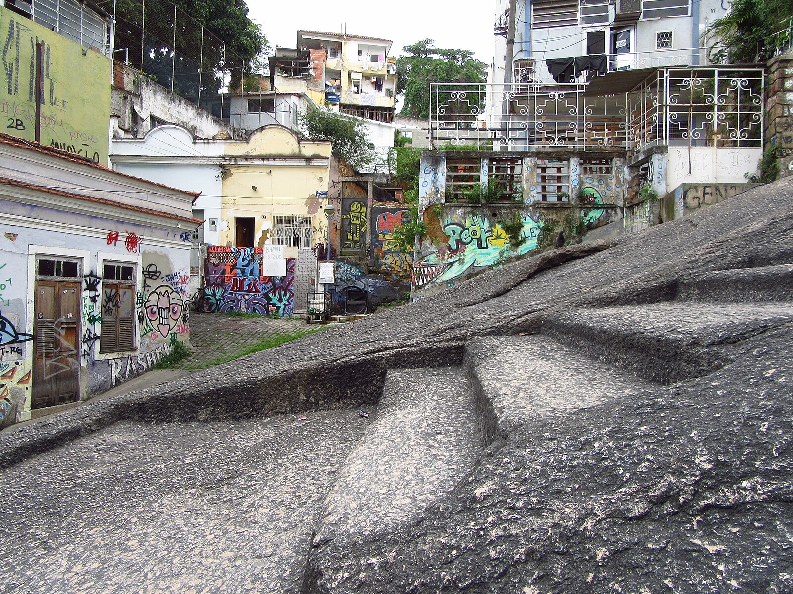
Pequena África — Little Africa — is the name long used for the old port neighbourhoods of Rio de Janeiro behind Praça Mauá, the square at the head of the cruise pier. Enslaved Africans were landed here in the early 19th century; later, early samba grew up in the same streets. Most visitors know the area for the free Monday samba at Pedra do Sal, about 250 metres from the stones of the Valongo Wharf.
In September Galeria Providência, a community arts and education group from the Providência hill behind the port, presented an online map of the area’s Black history at the Museu de Arte do Rio (MAR), the city-owned art museum on Praça Mauá. Memórias da Pequena África — Memories of Little Africa — has 1,200 entries, from musicians and songs to clubs, religious houses, heritage sites, writers and newspapers.

How many people were landed here
There is no complete record; every figure is a reconstruction, not a count. The archaeologists who excavated the wharf, citing the Trans-Atlantic Slave Trade Database, put arrivals in the whole port of Rio between 1811 and 1831 at about 550,000. UNESCO says up to 900,000 captives entered the Americas through Valongo; Brazil’s federal prosecutors say more than 900,000, and Rio’s city government more than a million.
For scale, the same database puts the number shipped directly from Africa to what is now the United States, over the whole history of the Atlantic trade, at about 390,000.
What “Little Africa” means
The name spread through a 1983 book by the writer Roberto Moura about Tia Ciata, a Bahian-born food seller and priestess of Candomblé, an Afro-Brazilian religion, in whose house early samba was played. Moura credits the samba composer and painter Heitor dos Prazeres with the name, for a territory running from the docks to Cidade Nova, with Praça Onze, a square just west of the port, as its capital.
Among the groups working on its history today are the Instituto dos Pretos Novos, named after the term for newly landed captives; the community around Pedra do Sal, recognised in 2005 by the federal Palmares Foundation as a quilombo, a community descended from enslaved people; and Galeria Providência.
The Providência hill is often called Rio’s first favela. Soldiers returning in 1897 from Canudos, a war against a religious settlement in the interior of Bahia state, settled there and called it Morro da Favela, after a hill in Bahia; “favela” became the Brazilian word for self-built neighbourhoods. The map’s own entry on the hill adds that maps, photographs and property advertisements show people living there decades earlier.
What is on the map
Of the 1,200 entries, about 1,100 are pinned to a point on the map. The largest groups are societies and associations (346), popular song (217) and heritage sites (206); the rest cover the visual and performing arts, religion, literature and the press. More than three quarters sit in the city centre and the port districts of Gamboa and Saúde. Each entry has a short text and a list of sources. The one on the wharf cites the UNESCO listing and the Brazilian nomination file, and reads its layered paving as showing “the attempt to hide the memory of the landing of enslaved Africans”.
Galeria Providência was founded in 2017 by Hugo Oliveira, an artist and researcher who lives on the hill; it began with neighbours and artists painting murals and now also runs education and memory projects. The map was conceived and built by Gabriel Ferreira, who also works on its curation and data; its curator is Elisa Carvalho, a historian trained at the Federal University of Rio de Janeiro who grew up on the hill. The site says some points are approximate because streets and buildings have disappeared, and that a channel for residents and others to send corrections and new entries is still being set up. It does not say who pays for it.
What World Heritage status does not mean
UNESCO listed the wharf under a single criterion, for its association with events of universal significance; its text calls it a “site of conscience”. The listing is a statement about what the place means. It is not a finding that the site is well kept or well explained. When it listed the site, the World Heritage Committee itself recommended that Brazil look for solutions to rainwater collecting in the excavation and develop an overall way of explaining the site, including to visitors who do not go to the nearby museum.
The clearest example is the visitor centre, still to be built nine years later in the Docas André Rebouças warehouse facing the wharf, named after the 19th-century Black engineer and abolitionist who built the original warehouse. The building already holds the city’s urban archaeology laboratory. An earlier federal court ruling in a case brought by Brazil’s federal prosecutors ordered the government to meet the obligations it took on with UNESCO. This year, with the project at risk of stalling for lack of money, the prosecutors went back to court and a judge ordered R$10 million (about US$1.9 million) released from a federal fund. On 18 August the federal government held a ceremony to launch the conversion, which TV Brasil, the public broadcaster, reported at R$77 million (about US$15 million) and about three years of works.
The city says it has spent more than R$20 million (about US$3.9 million) on conservation and research since 2014, and that its laboratory holds about 1.5 million objects found in the port area.
The objection: who the upgrade was for
The wharf was found because the city was rebuilding the port. Porto Maravilha, launched in 2009 ahead of the 2014 World Cup and the 2016 Olympics, brought a light rail line, new museums and a waterfront promenade. It was paid for largely by selling certificates for extra building rights, all of which were bought in 2011, in a single lot, by a fund run by the state bank Caixa with money from the FGTS, the workers’ severance fund.
On the Providência hill, a city upgrade plan launched in 2010 marked hundreds of homes for removal. The city said about 380 families lived in areas at risk of landslides and 291 had to make way for a cable car and a funicular. Residents, backed by the state public defender’s office, went to court, which halted the works in late 2012 and suspended removals in March 2013. The residents’ own map describes the cable car both as “the mark of an authoritarian urban intervention” and as part of today’s disputes over the hill; one of its stations was built on the square where people held festivals and meetings.
The dispute has not ended. In May 2026 federal prosecutors warned that a new city plan for Praça Onze “opens the way for gentrification”, in which rising property values and the privatisation of public land push out low-income residents.
The city points to what has arrived. The cable car, out of service from 2017 until it reopened fully in February 2025, is free for residents and visitors and had carried four million passengers by 1 September 2026 — about 7,000 a day. Residents now also use its viewpoint for their own guided tours.
Pedra do Sal is not the Valongo Wharf
Pedra do Sal, “Salt Rock”, is a rock face and square at the foot of the Conceição hill where enslaved men unloaded salt, and later a meeting place for dockworkers and Bahian families among whom early samba grew. The quilombo community lives around it. Its free Monday samba, outdoors from about 7pm, is what most visitors know. The Valongo Wharf is a separate archaeological site about 250 metres away, where enslaved Africans were brought ashore from the ships.
How to see it
The wharf is in Jornal do Comércio Square, on Avenida Barão de Tefé in Saúde. The nearest stop of the VLT light rail, Parada dos Navios – Valongo on Line 1, is a few minutes’ walk away; Praça Mauá is about 650 metres away. It is an open public square and free to see, with information panels on site.
The Instituto dos Pretos Novos, a research centre and museum on the site of a burial ground for Africans who died soon after arrival, is at Rua Pedro Ernesto 32/34 in Gamboa, open Tuesday to Friday 10am–4pm and Saturday 10am–1pm. Entry is free on Tuesdays for Brazilian citizens; other visitors pay. A free exhibition there on the wharf’s preservation runs until 24 October. On Saturdays until 19 December the institute leads free walks of about three and a half hours on the city’s African Heritage Circuit, which links the wharf, Pedra do Sal and the Valongo hanging garden; they start at the Largo de São Francisco da Prainha and are booked on a Portuguese-language page.
The city’s archaeology laboratory, in the warehouse at Avenida Barão de Tefé 75, offers free guided visits on weekdays by appointment, and its work can be watched through glass windows.
What comes next
The visitor centre has a building, federal money and an estimate of about three years of works, but no opening date. The map’s makers say it will keep growing, with contributions from residents once their channel is open.
None of this makes the map an official register: what goes on it is the group’s own curatorial decision. And Pequena África is not a museum district. People live there, and whether they can afford to stay is still in dispute.
Frequently Asked Questions
What is Pequena África?
A name, not an official district, for Rio de Janeiro’s old port neighbourhoods of Saúde, Gamboa and Santo Cristo and the hills around them, where much of the city’s Black history took place. The name spread through Roberto Moura’s 1983 book on Tia Ciata and early samba.
Can I visit the Valongo Wharf, and is there anything to see?
Yes. It is an open, free site in Jornal do Comércio Square, near the Parada dos Navios light-rail stop, where you look down on stone paving from 1811 and 1843 behind a railing, with information panels. There is no visitor centre yet. The Instituto dos Pretos Novos runs free Saturday walks of the area, booked on a Portuguese-language page.
What is the difference between Pedra do Sal and the wharf?
Pedra do Sal is a rock and square at the foot of the Conceição hill where enslaved men once unloaded salt, known today for free samba on Monday evenings. The Valongo Wharf, about 250 metres away, is the archaeological site where enslaved Africans were landed and which UNESCO listed in 2017.
Is the new map of Pequena África available in English?
No. As of 27 September 2026 the platform is in Portuguese only, and the site mentions no plans for an English version.
Sources: UNESCO World Heritage Centre, Valongo Wharf Archaeological Site, list entry 1548; Memórias da Pequena África, pages “Sobre” and “Metodologia” and entry data; Federal Public Prosecutor’s Office (MPF), Rio de Janeiro, statements of 8 May and 20 August 2026; Ministry of Culture press notice, 17 August 2026; City of Rio de Janeiro, statements of 26 February and 1 September 2026; Instituto dos Pretos Novos; Diário do Rio, 23 September 2026; City of Rio de Janeiro, 23 November 2023; TV Brasil, 18 August 2026; Observatório das Metrópoles, 29 March 2017; Agência Pública, June 2013; Sant’Anna and Gonçalves, Interseções, December 2015; Lima, Sene and Souza, Anais do Museu Paulista, vol. 24 no. 1, 2016; UNESCO World Heritage Committee, decision 41 COM 8B.35, 2017; Instituto dos Pretos Novos, walk and ticket pages on Sympla; Roberto Moura, Tia Ciata e a Pequena África no Rio de Janeiro, 1983; Trans-Atlantic Slave Trade Database (Eltis and Richardson), as cited by PBS. All retrieved 27 September 2026.
This article was produced by The Rio Times’ automated newsroom system. How we use AI · Report an error
Read More from The Rio Times