Hurricane Rachel Strengthens Off Mexico: Coastal Warnings Dropped, Major Hurricane Forecast
MEXICO · WEATHER · TRAVEL SAFETY
Key Facts
- The storm Hurricane Rachel had 90 mph (150 km/h) sustained winds and a 975-millibar pressure at the US National Hurricane Center’s 8 p.m. MST advisory on Wednesday 30 September (03:00 UTC, 1 October), about 200 miles (320 km) west-southwest of Cabo Corrientes, moving northwest at 7 mph (11 km/h).
- The warnings There are no coastal watches or warnings in effect. The tropical-storm warnings that covered the Michoacán–Colima–Jalisco coast on Wednesday have been dropped as Rachel moves away from the mainland.
- The forecast Rachel could strengthen rapidly overnight and on Thursday 1 October and become a major hurricane — Category 3 or stronger — within the next couple of days, while passing south of the Baja California Peninsula.
- The rain Additional totals of 2 to 4 inches, with isolated storm totals of 12 inches, are forecast across coastal Guerrero, Michoacán, Colima and Jalisco. Life-threatening flooding and mudslides remain possible in steep terrain.
- What it means for you The wind threat to the mainland is receding, but beaches from Guerrero to Jalisco — and later the southern Baja — stay dangerous through the end of the week. Rip currents kill far from the center, under calm skies.
- Still open Rachel’s peak intensity and how close the outer bands come to Los Cabos on Thursday. The next full NHC advisory is due at 2 a.m. MST (09:00 UTC).
Mexico’s Pacific coast is standing down from warnings as Hurricane Rachel pulls away to the northwest — but the storm is still strengthening over open water, and the ocean it leaves behind remains lethal.
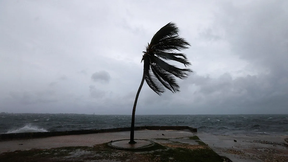
Where Rachel Is Now
Rachel spent Wednesday moving slowly away from the Mexican mainland. By the NHC’s 8 p.m. MST advisory (03:00 UTC Thursday), the center sat near 19.2°N, 108.5°W — roughly 200 miles (320 km) west-southwest of Cabo Corrientes, at the mouth of Puerto Vallarta’s bay, and 270 miles (435 km) south-southeast of Cabo San Lucas.
Maximum sustained winds rose to 90 mph (150 km/h) with higher gusts, and the central pressure fell to 975 millibars. Hurricane-force winds extend only 35 miles (55 km) from the center; tropical-storm-force winds reach 150 miles (240 km). Rachel is moving northwest at 7 mph (11 km/h) and is forecast to pass south of the Baja California Peninsula on Thursday before turning west later in the week.
Our earlier report covered Rachel’s landfall approach and the warning phase: Hurricane Rachel Off Mexico’s Pacific Coast: What Travelers Need to Know. Rachel is the second named storm to brush this coast in a week, after Hurricane Polo dissipated over northwestern Mexico without reported deaths.
The Warnings Are Dropped — What That Means
The tropical-storm warning that covered the coast from Punta San Telmo to Playa Perula — the strip that includes Lázaro Cárdenas, Manzanillo and Barra de Navidad — and the watch north toward Cabo Corrientes are no longer in effect. The NHC’s Wednesday-night advisory lists no coastal watches or warnings.
That is a statement about wind, not about water. Tropical-storm-force gusts remain possible along parts of the southwestern coast through the night, and Mexico’s Servicio Meteorológico Nacional still issues the local alerts that govern ports, schools and beaches. The NHC advises that interests in the southern portion of Baja California Sur — including the Los Cabos resort corridor — should monitor Rachel’s progress.
Rain and Surf Remain the Risk
For anyone on land, water is still the hazard. Rachel is forecast to produce additional rainfall of 2 to 4 inches, with isolated maximum storm totals of 12 inches, across coastal Guerrero, Michoacán, Colima and Jalisco. Life-threatening flooding and mudslides are possible, especially in steep terrain above the coastal highway.
Swells generated by Rachel will affect the southwestern coast for the next couple of days and spread northward along west-central Mexico and the Baja California Peninsula through the end of the week. These swells produce life-threatening surf and rip currents — the leading cause of hurricane-related deaths on coasts the storm never touches. Beaches that look calm can be deadly; local red-flag systems, not the sky, are the guide.
For travelers, the practical picture improves: airports at Manzanillo, Puerto Vallarta and Los Cabos operate outside the warning area, and the mainland wind risk is receding. Anyone with beach plans between Zihuatanejo and Cabo San Lucas should treat the water, not the wind, as the reason to change them.
What We Could Not Confirm
Rachel’s peak intensity: the NHC says the storm could become a major hurricane within a couple of days, but rapid strengthening is a possibility, not a certainty, and easterly wind shear may limit it in the short term. How close the outer bands will pass to Los Cabos on Thursday is likewise not yet fixed. The NHC is also issuing advisories on a separate system, Tropical Depression Nineteen-E, elsewhere in the eastern Pacific; its development is beyond the scope of this report.
Frequently Asked Questions
Is Hurricane Rachel going to hit Mexico?
No landfall is forecast. The NHC expects Rachel’s center to move away from mainland Mexico and pass south of the Baja California Peninsula on Thursday 1 October 2026. All coastal watches and warnings have been dropped, though tropical-storm-force gusts remain possible along parts of the southwestern coast overnight.
How strong is Hurricane Rachel now?
At the NHC’s 8 p.m. MST advisory on Wednesday 30 September (03:00 UTC, 1 October), Rachel had maximum sustained winds of 90 mph (150 km/h) and a central pressure of 975 millibars — a Category 1 hurricane. Rapid strengthening is possible, and Rachel could become a major hurricane within a couple of days.
Is it safe to swim in Puerto Vallarta or Los Cabos during Rachel?
No. Swells from Rachel will affect southwestern Mexico for days and spread to the Baja California Peninsula through the end of the week, producing life-threatening surf and rip currents. Follow local beach-flag systems and Civil Protection instructions, even under calm skies.
Which parts of Mexico will get rain from Rachel?
Coastal portions of Guerrero, Michoacán, Colima and Jalisco are forecast to receive additional rainfall of 2 to 4 inches, with isolated maximum storm totals of 12 inches. Flooding and mudslides are possible in steep terrain.
What is the difference between Rachel and Hurricane Polo?
Polo struck earlier in the week and dissipated over northwestern Mexico without reported deaths. Rachel formed later, further south, and is stronger — but its forecast track keeps the center offshore. Both storms’ main land hazard is water: rain, flooding and surf rather than wind.
Sources
- US National Hurricane Center — Hurricane Rachel Public Advisory No. 16, 8 p.m. MST Wednesday 30 September 2026 (03:00 UTC, 1 October)
- US National Hurricane Center — Tropical Cyclone Discussion, Hurricane Rachel, 30 September 2026
- The Rio Times — Hurricane Rachel Off Mexico’s Pacific Coast: What Travelers Need to Know (30 September 2026)
This article was produced by The Rio Times’ automated newsroom system. How we use AI · Report an error
Read More from The Rio Times
Rotate for Best Experience
This report is optimized for landscape viewing. Rotate your phone for the full experience.
You've reached your free article limit
Subscribe to The Rio Times for unlimited access to expert analysis, market intelligence, and daily briefings on Latin America.