PHILIPPINES · ANALYSIS
Key Facts
- —What is happening Chinese scholars said at a 30 June discussion at Jinan University that the Batanes islands were historically part of Taiwan, drawing controversy in the Philippines.
- —Why it matters The Batanes Bashi Channel is a deep-water corridor linking the South China Sea to the Pacific, used by commercial shipping, undersea cables and naval forces.
- —The numbers Batanes had 18,831 residents in the 2020 census and its economy grew 9.6 percent in 2024, according to the Philippine Statistics Authority.
- —Who is who The United States and the Philippines are treaty allies under the 1951 Mutual Defense Treaty.
- —What to watch Whether Beijing formally adopts the scholars’ argument and whether more Chinese research vessels enter Philippine waters around Batanes.
- —What it means for you A crisis around Batanes could raise shipping insurance premiums and disrupt routes between the South China Sea and the Pacific, affecting US importers and investors.
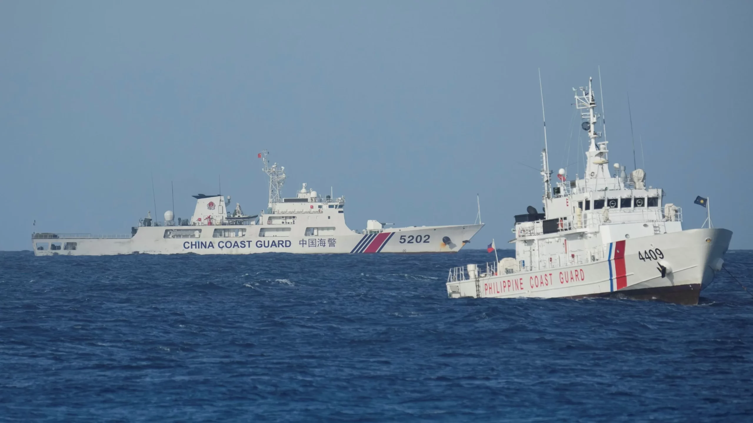
The Batanes Bashi Channel has become a flashpoint because Chinese scholars now claim the Philippine islands were historically part of Taiwan. For US readers, the dispute tests whether the 1951 US-Philippines Mutual Defense Treaty would cover an incident in the northern approaches to Taiwan.
Batanes is the Philippines’ northernmost province, a scattering of islands between Luzon and Taiwan that overlooks one of Asia’s most important maritime corridors. This analysis explains the geography, the scholars’ remarks, the Philippine reaction, and what the controversy means for US Taiwan Strait planning, shipping lanes and the US-Philippines alliance, drawing on the Asia Intelligence Brief.
Where Batanes Sits and Why It Matters
Batanes is made up principally of Batan, Itbayat and Sabtang, plus smaller islands including Mavulis. It lies north of Luzon, south of Taiwan and west of the Bashi Channel, the section of the Luzon Strait that connects the South China Sea with the Philippine Sea.
The province is small in population, with 18,831 residents recorded in the 2020 Census of Population and Housing, according to the Philippine Statistics Authority. Its economy grew 9.6 percent in 2024, also according to the PSA, but its strategic value far outweighs its economic weight.
The Bashi Channel is one of the few deep-water passages through which vessels can move between the South China Sea and the Western Pacific. Commercial shipping, submarine cables and naval forces all use the corridor, making Batanes a geographic bridge between the Philippines and Taiwan, though not a legal extension of either.

The Scholars’ Remarks and the Philippine Reaction
Chinese scholars reportedly argued that Batanes was a natural geographic extension of Taiwan and therefore fell under Chinese sovereignty, because Beijing claims Taiwan as part of China.
The argument was later amplified in Chinese state-linked commentary, including claims that postwar treaties failed to transfer Batanes properly to the Philippines and that the islands had once been under the jurisdiction of Taiwan Prefecture during the Ming and Qing periods. The remarks came from academics, not from a formal territorial declaration by Beijing, a distinction that matters for now.
Philippine officials nevertheless treated the episode as serious. Philippine officials nevertheless treated the episode as serious.
The NHCP also disputed the assertion that Batanes was governed by China during the Ming and Qing periods. The NHCP also disputed the assertion that Batanes was governed by China during the Ming and Qing periods. According to the commission, Ivatan communities lived in protected settlements and traded with maritime neighbours.
Defense Secretary Gilberto Teodoro called the claims baseless and ludicrous, while saying they had to be challenged. Defense Secretary Gilberto Teodoro called the claims baseless and ludicrous, while saying they had to be challenged.

The Bashi Channel: Shipping, Cables and Military Access
The Bashi Channel matters for three overlapping reasons. First, commercial vessels moving between Southeast Asian ports, the South China Sea and the Pacific use the Luzon Strait’s passages, including the Bashi Channel. Disruption would affect routes connecting China, Taiwan, Japan, Korea, the Philippines and global markets.
Second, the channel is a logical passage for submarine cables linking East and Southeast Asia. Cable routes are commercially critical and strategically sensitive, although the precise locations and vulnerabilities of individual systems should not be assumed without operator or government confirmation.
Third, the channel is one of the few deep-water routes through which Chinese naval forces can move between the South China Sea and the Pacific. It is also relevant to US and allied surveillance, submarine operations, logistics and Taiwan-contingency planning.
For Beijing, the channel sits on the southern approach to Taiwan and on the route connecting the People’s Liberation Army Navy’s South China Sea operating area with the Philippine Sea. For Washington and Manila, it is part of the maritime space surrounding Taiwan and the northern Philippine approaches.
Batanes itself does not command the entire channel. Its islands are dispersed, lightly populated and difficult to sustain militarily. Their value is instead geographic: they provide observation points, potential logistics locations and political jurisdiction close to Taiwan.
The US-Philippines Alliance Connection
The United States and the Philippines are treaty allies under the 1951 Mutual Defense Treaty. The alliance has become more operationally relevant in northern Luzon because the Philippines provides access to territory facing the Bashi Channel and Taiwan.
The 2014 Enhanced Defense Cooperation Agreement permits US forces to rotate through designated Philippine facilities and allows the construction or improvement of agreed defence infrastructure. The nearest established EDCA locations to Batanes are in Cagayan, rather than in Batanes itself.
That distinction is important. There is no publicly identified EDCA site in Batanes, so the islands are not equivalent to a permanent US base. Nonetheless, northern Luzon facilities can support surveillance, air operations, logistics and maritime denial close to the channel.
Recent exercises have increased the alliance’s attention to Batanes. Philippine and US planning has increasingly treated the northern archipelago and Cagayan as part of a connected operating area rather than as isolated local-defence zones.
What This Means for US Taiwan Strait Planning
Batanes expands the geography of a Taiwan contingency. Planning centred only on the Taiwan Strait misses the southern approaches through the Bashi Channel and the Philippine side of the Luzon Strait.
The islands matter to US planners in at least four ways. Philippine territory can support aircraft, sensors, fuel, maintenance and distributed logistics. Mobile anti-ship systems and surveillance networks on northern Philippine islands could complicate naval movement through the channel. Sensors in Batanes and northern Luzon could improve awareness of maritime and air activity around Taiwan’s southern approaches. Dispersed sites reduce dependence on a small number of major bases, although remote islands are also harder to defend and resupply.
The policy challenge is balancing deterrence with escalation control. A visible US military presence in Batanes might signal that coercion there would involve the alliance. It could also make the islands a more prominent target in a Taiwan crisis. Manila must therefore decide how much military infrastructure it wants in a province whose communities face severe weather, limited transport links and economic constraints.
For Washington, the best policy is unlikely to be treating Batanes as a new permanent base. A more sustainable approach would combine Philippine-led coastal surveillance, resilient communications, humanitarian and disaster-response infrastructure, rotational exercises, pre-positioned non-sensitive supplies and clear rules for alliance consultation.
The September 2026 Research Vessel Incident
The controversy escalated from historical argument into an operational dispute in late September and early October 2026.
The Philippine Department of Foreign Affairs said the vessel was inside the country’s exclusive economic zone.
China’s embassy rejected Manila’s position, asserting that China had sovereign rights and jurisdiction in the relevant waters. The incident therefore supplied a practical test of whether the historical argument would remain rhetorical or become linked to Chinese maritime activity.
Shipping, Investors and Expatriates: The Practical Stakes
A crisis around Batanes would initially be more likely to affect risk pricing and routing than everyday life on the islands. Potential effects include higher insurance premiums for vessels operating near the Luzon Strait, delays or rerouting for shipping between the South China Sea and the Pacific, and increased scrutiny of maritime research, cable-laying and survey activity.
There would also be greater demand for surveillance, communications and coastal-defence systems, more Philippine public spending on northern-island transport, ports, airfields and disaster resilience, and higher geopolitical risk for projects that depend on uninterrupted access through the Taiwan-Philippines corridor.
Batanes is not a major commercial port or industrial centre. Its economic importance is therefore strategic rather than based on local output. Any investment thesis should distinguish between infrastructure that benefits residents, such as airports, ferries, telecommunications, power and disaster resilience, and facilities whose primary purpose is military access.
What It Means for You
For US readers, the Batanes dispute is a test of alliance credibility in the Indo-Pacific. If Beijing were to formalise the scholars’ argument or expand maritime activity around Batanes, Washington would face pressure to demonstrate that the Mutual Defense Treaty covers Philippine territory and forces in the northern approaches.
For investors and executives, the immediate exposure is through shipping costs and supply-chain reliability. Any disruption to the Bashi Channel would affect routes connecting China, Taiwan, Japan, Korea and Southeast Asia, with knock-on effects for US importers and manufacturers.
For expatriates and policy readers, the episode illustrates how academic historical claims can become operational maritime disputes. The distinction between a scholar’s argument and a formal territorial claim matters, but the Philippine government has treated the episode as a warning sign rather than a purely academic exercise.
What Is Not Known
Several crucial facts remain unresolved. No formal Chinese territorial claim has been established solely by the scholars’ remarks.
The chain of institutional sponsorship is unclear. It is not yet clear whether the symposium represented an official policy initiative, an academic exercise, or a trial balloon tolerated by Chinese authorities.
The legal merits have not been adjudicated internationally. Philippine historical evidence and administrative practice support Manila’s position, but the dispute has not been resolved through a specific international judgment on the claims described here.
The operational purpose of JIA HAI KE 7 is not fully public. Manila characterised its activity as unauthorised marine scientific research, but public reporting does not establish exactly what data were collected, for whom, or whether the voyage was connected to the academic claims.
US contingency plans are classified. Public exercises and EDCA locations demonstrate preparation, not a disclosed decision to use Batanes in a specific Taiwan scenario. The treaty threshold is fact-dependent, and not every coast-guard confrontation, research-vessel incident or maritime-law dispute would automatically trigger US military intervention.
What to Watch
The next six months will reveal whether Beijing moves from academic argument to formal claim. Watch for any statement from China’s State Council or Foreign Ministry that adopts the scholars’ language about Batanes as a natural geographic extension of Taiwan.
Watch also for further Chinese research-vessel or coast-guard activity around Batanes, particularly near Itbayat and Mavulis. The September 2026 JIA HAI KE 7 incident may have been a one-off, or it may signal a pattern of testing Philippine maritime jurisdiction in the Bashi Channel.
On the Philippine side, watch for announcements about new infrastructure in Batanes or northern Luzon, including any expansion of EDCA-adjacent facilities. Manila’s decisions about how much military access to allow in Batanes will shape the alliance’s posture without necessarily creating a permanent US base.
Finally, watch the next Balikatan exercise cycle. If the 2026 iteration repeats or expands the NMESIS deployment seen in 2025, it will confirm that the alliance treats Batanes as part of a connected operating area for Taiwan contingencies.
Frequently Asked Questions
Where are the Batanes Islands?
Batanes is the Philippines’ northernmost province, made up principally of Batan, Itbayat and Sabtang, plus smaller islands including Mavulis. It lies north of Luzon, south of Taiwan and west of the Bashi Channel.
Why does the Bashi Channel matter?
The Bashi Channel is a deep-water corridor linking the South China Sea with the Philippine Sea and the wider Western Pacific. It is used by commercial shipping, submarine cables and naval forces, including Chinese vessels moving between the South China Sea and the Pacific.
How did the Philippines respond to the Batanes claims?
Philippine officials treated the episode as serious.
Is there a US military base in Batanes?
No. There is no publicly identified Enhanced Defense Cooperation Agreement site in Batanes. The nearest established EDCA locations are in Cagayan.
What was the JIA HAI KE 7 incident?
In late September and early October 2026, The Philippine Department of Foreign Affairs said the vessel was inside the country’s exclusive economic zone.
Would the US defend Batanes under the Mutual Defense Treaty?
The United States has stated that an armed attack on Philippine armed forces, public vessels or aircraft anywhere in the South China Sea would invoke treaty commitments. The precise application to any incident around Batanes would depend on the facts, including the vessel involved, the location and whether the event met the treaty’s armed-attack threshold.
Sources: riotimesonline.com, scmp.com, scmp.com, pia.gov.ph, gmanetwork.com, atlanticcouncil.org. Retrieved 10 October 2026.
This article was produced by The Rio Times’ automated newsroom system. How we use AI · Report an error · Editorial responsibility: Matthias Camenzind, Editor-in-Chief