
GHANA · REGIONS
Key Facts
- —The basics Ghana is divided into 16 regions, each headed by a regional minister whom the president appoints, after voters approved six new regions in a referendum on Thursday, 27 December 2018.
- —Why it matters The regions decide where Ghana’s people, jobs, votes and public money sit, from the crowded coast and the gold and cocoa forest belt to the larger, drier and poorer north.
- —The numbers The 2021 census counted 30.8 million people, including 5.45 million in Greater Accra and 5.43 million in Ashanti, and the population is projected at 34.4 million as of October 2026.
- —Who is who President John Mahama of the National Democratic Congress, in office since 7 January 2025, appoints all 16 regional ministers, while Mahama Ayariga, minister for local government, chieftaincy and religious affairs, oversees the 261 district assemblies.
- —What to watch Ghana’s next general election is due in December 2028, when voters in all 16 regions choose a president and 276 members of Parliament, one for each constituency.
- —What it means for you US visitors mostly land in Greater Accra and travel on to Kumasi, Cape Coast or the north, while investors in gold and cocoa deal mainly with the southern forest regions.
Sixteen regions divide Ghana, but people, money and political power are concentrated in a few of them. This guide explains each part of the map as of October 2026.
Ghana regions are the 16 administrative units of the West African country, each run by a regional minister and a council. Below them sit 261 metropolitan, municipal and district assemblies that handle local services.
Where people, money and political loyalty sit differs sharply between the south and the north. Below, each region is explained for US readers, investors and visitors, with figures dated as of October 2026.
Population figures come from the Ghana Statistical Service (GSS), the national statistics office, and its 2021 Population and Housing Census. Political facts come from the Presidency, Parliament and the Electoral Commission.
Daily news is in the Rio Times Ghana section. For the power structure behind the map, see who holds power in Ghana, and for the country’s artists see Ghana culture explained.
How Ghana Regions and Districts Work
Ghana is a unitary republic, so its regions are not states or provinces with their own parliaments. Power flows from the national government in Accra, and the president appoints the regional ministers who represent it.
Each region has a coordinating council that links the national ministries with the district assemblies below. The Constitution Review Committee, which reported in January 2026, counts 16 regions and 261 assemblies in total.
District chief executives, who run the assemblies day to day, are also appointed by the president. Their nomination needs the approval of two thirds of the assembly members present and voting.
Traditional rulers add a second layer of authority that a US reader rarely meets at home. Chiefs keep influence over land and local disputes, but Article 276 of the Constitution bars them from party politics.
Ghana covers 238,533 square kilometres, slightly smaller than Oregon, according to GSS. The provisional 2021 census counted 30,792,608 people, or 129 people per square kilometre on average.
From 10 to 16 Regions, the 2018 Referendum
Before 2018, Ghana had ten regions for more than three decades. Voters in the affected areas approved six new regions in referendums held on Thursday, 27 December 2018.
The new regions were carved out of four old ones. Savannah and North East came from the Northern Region, while Bono, Bono East and Ahafo replaced the former Brong-Ahafo Region.
Oti was split from the Volta Region, and Western North was separated from the Western Region. Supporters argued that smaller regions would bring government offices, roads and jobs closer to remote towns.
The Electoral Commission declared the results on Friday, 28 December 2018, with yes votes above 98% in all six areas. Ahafo recorded the highest yes share, 99.68%, and Oti the lowest, 98.64%.
The 2021 census was the first to count all 16 regions. It shows how unequal they are in size, from Savannah at 34,790 square kilometres to Greater Accra at just 3,245.

Greater Accra, the Crowded Capital Region
Greater Accra is the smallest region by area but had the most people in 2021, with 5,446,237 residents. Its density of 1,678 people per square kilometre is about six times that of Central, the next most crowded region.
The region holds the capital, Accra, the seat of the Presidency, Parliament and most ministries and embassies, including the US Embassy. Kotoka International Airport and the port of Tema make it the main gateway for visitors and trade.
Households here are among the smallest in the country, at 3.2 people on average in 2021. That compares with a national average of 3.6 and six people in the North East Region.
For newcomers, the Rio Times guide to living in Accra covers neighbourhoods, costs and safety. Most foreign residents in Ghana live and work in this region.
Ashanti and the Forest Belt, Gold and Cocoa
Ashanti, with 5,432,485 people in 2021, is almost as populous as Greater Accra. Together the two regions hold more than a third of all Ghanaians, which GSS highlights in its census results.
Its capital, Kumasi, is Ghana’s second city and the seat of the Asante king, the Asantehene, whose court remains influential. The region sits in the forest belt, where gold mining and cocoa farming have shaped the economy for generations.
The forest belt continues into the Western, Western North, Eastern, Central, Bono and Ahafo regions. Ahafo is the smallest region by population, with 564,536 people counted in 2021.
This belt is also where illegal small-scale mining, known in Ghana as galamsey, does the most damage to rivers and farmland. President Mahama calls the destruction of forests and water bodies by illegal mining one of the country’s most serious dangers.
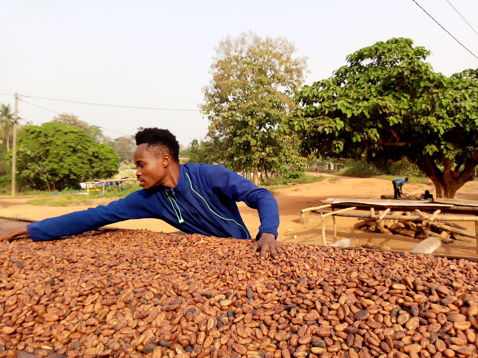
The Coast and the East, Central, Western, Volta and Oti
Central Region, with 2,859,821 people in 2021, holds Cape Coast and Elmina, whose old European slave-trade castles draw many African American visitors. Western Region, with 2,057,225 people, holds the twin city of Sekondi-Takoradi and Ghana’s offshore oil industry.
Eastern Region had 2,917,039 people in 2021, making it the third most populous. Its capital, Koforidua, lies within easy reach of Accra, and the region shares the vast Volta Lake with its neighbours.
Volta Region, east of the lake along the border with Togo, counted 1,649,523 people in 2021. GSS found that women outnumber men more strongly there than in any other region.
Oti, the northern strip of the old Volta Region, had 747,227 people in 2021. Western North, a cocoa and timber region, is where men most outnumber women, by 2.6 percentage points.
The North, Five Regions and the Development Gap
Five regions make up Ghana’s north: Northern, Savannah, North East, Upper East and Upper West. They cover about 41% of the land but held about 19% of the people in 2021, based on GSS data.
Northern Region, with Tamale as its capital, had 2,310,943 people in 2021, the largest number in the north. Savannah is the largest region by area and the most thinly populated, with about 19 people per square kilometre.
Savannah’s capital, Damongo, is President Mahama’s birthplace, according to his official biography. Upper East had 1,301,221 people, Upper West 904,695 and North East 658,903 in the 2021 count.
Households in the north are much larger than in the south, at 6.0 people in North East and 5.2 in Northern. Nationally, GSS put multidimensional poverty at 21.9% in the third quarter of 2025, without a regional split on its main page.
Regional Tensions, Chieftaincy, Mining and Votes
The sharpest regional tension is the long-running chieftaincy conflict in Bawku, in the Upper East Region near Burkina Faso and Togo. Mahama has said that nobody is happy about the situation and has urged faster mediation, praising the Mamprugu king, the Naa-Yiri.
Galamsey creates a second kind of tension, between miners, farmers, chiefs and the state in the forest regions. On 29 August 2026 Mahama swore in Zanetor Agyeman-Rawlings as environment minister and told her to lead the fight against galamsey.
Votes also follow regional lines, with Ashanti a long-standing base of the New Patriotic Party (NPP), the conservative opposition party. Volta has long been a base of the National Democratic Congress (NDC), Mahama’s centre-left party.
In December 2024, Mahama won 56.42% of the presidential vote against 41.75% for the NPP’s Mahamudu Bawumia, the Electoral Commission says. As of October 2026 the NDC holds 185 of 276 seats in Parliament, the NPP 87 and independents 4.
What It Means for US Readers
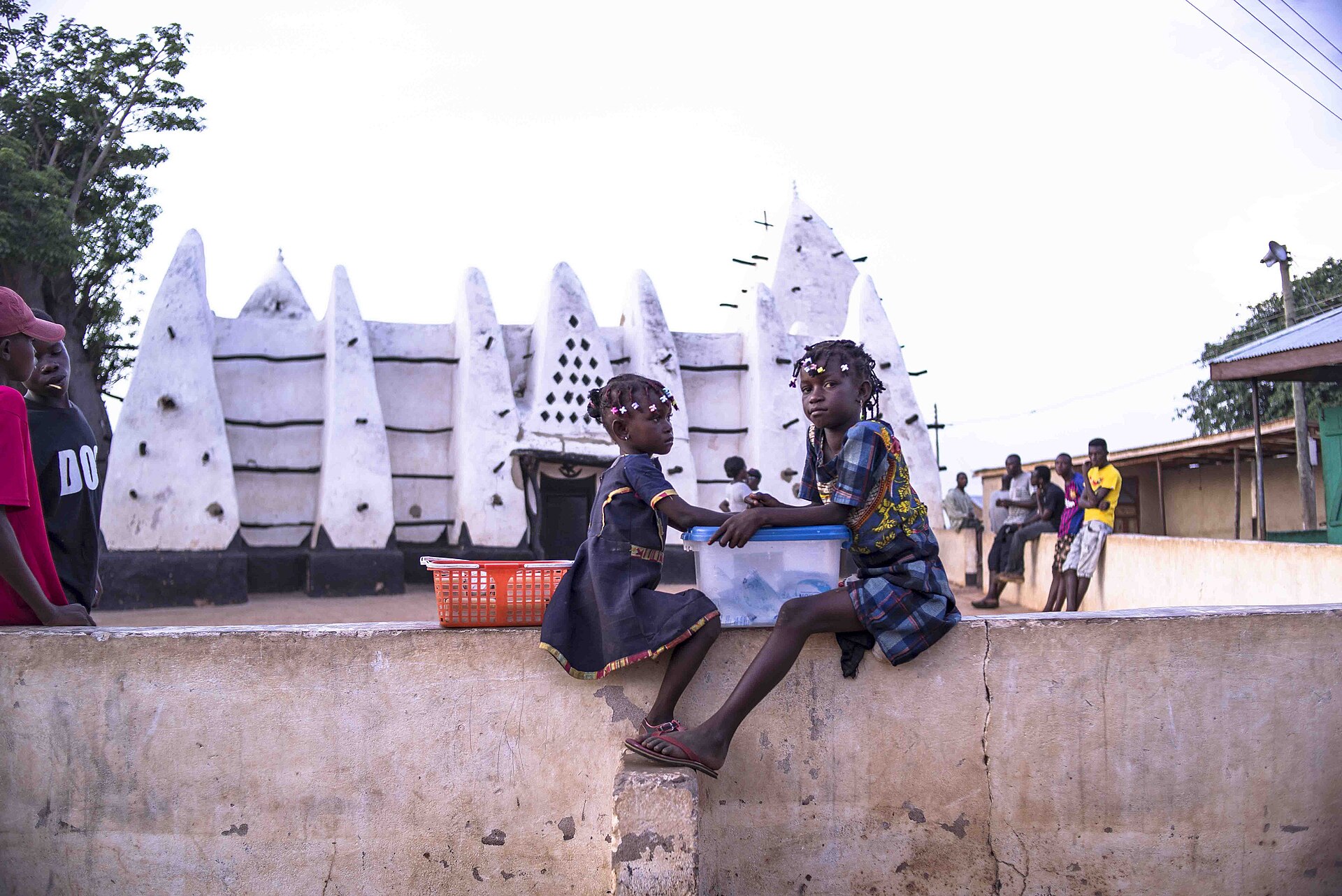
For US travellers, the map is a practical guide: Greater Accra for arrival and business, Central for the castles and beaches. Ashanti offers Kumasi’s markets and Asante heritage, and the north offers Mole National Park and mud-built mosques such as Larabanga.
For US investors, gold, cocoa and oil sit in the southern and western regions, while government decisions are taken in Accra. Regional ministers are presidential appointees, so national policy matters more than regional politics for most business.
For anyone relocating, the gap between the regions in services, housing and jobs is large. Wider context is in Ghana explained and Ghana in West Africa.
What Is Not Known
Final 2021 census figures differ slightly from the provisional numbers used here. Regional projections for 2026 are not on the GSS main page, and regional GDP is not published as an official series.
Whether the Bawku conflict ends through mediation, and whether the crackdown on galamsey cuts river pollution, is still open. GSS plans the next census for 2030, but no release timeline has been announced.
Frequently Asked Questions
How many regions does Ghana have?
Ghana has 16 regions, after six new ones were approved in referendums on 27 December 2018. Before that, it had ten regions.
Does Ghana have provinces or states?
No, Ghana is a unitary republic divided into regions, not provinces or states. Each region is led by a regional minister appointed by the president.
Which is the most populous region of Ghana?
Greater Accra had the most people in the provisional 2021 census, with 5,446,237. Ashanti followed closely with 5,432,485.
Which is the largest region of Ghana by area?
Savannah is the largest region, covering 34,790 square kilometres. Greater Accra is the smallest, at 3,245 square kilometres.
What are the newest regions of Ghana?
The newest regions are Savannah, North East, Bono East, Ahafo, Oti and Western North. They were created after the 2018 referendums.
Which region is Kumasi in?
Kumasi is the capital of the Ashanti Region, Ghana’s second most populous region. It is also the seat of the Asante king, the Asantehene.
Sources: Ghana Statistical Service, 2021 Population and Housing Census provisional results; Ghana Statistical Service, Ghana at a Glance (projected population, poverty); The Presidency, President Mahama’s profile; The Presidency, Ayariga and Agyeman-Rawlings sworn in; The Presidency, Bawku mediation; Constitution Review Committee, final report; Parliament of Ghana; Daily Graphic, results of the 2018 referendums on six new regions; Electoral Commission of Ghana, 2024 presidential results (all accessed 14 October 2026).
This article was produced by The Rio Times’ automated newsroom system. How we use AI · Report an error · Editorial responsibility: Matthias Camenzind, Editor-in-Chief
Part of our ongoing coverage
Africa: The New Scramble — the great-power contest over the continent.
Expat Guide to Ghana
What The Rio Times publishes for foreigners who live in or move to Ghana.
Start here
- Retire in Ghana 2026 — Residency, Costs and Daily Life for Foreign Retirees
- Opening a Bank Account in Ghana as a Foreigner 2026 — Documents and Real Costs
- Healthcare in Ghana for Expats 2026 — Private Care and NHIS
- Ghana Residency Visa 2026 Permits, E-Visa and Right of Abode
City guides
Understand Ghana