RIO DE JANEIRO, BRAZIL – Satellite images taken between 1985 and 2020 and analyzed by MapBiomas revealed to researchers a significant expansion of agriculture in Brazil during these 35 years. Areas of crops such as soy and corn, for example, tripled.
Soybean plantations already occupy an area larger than Italy and are comparable to the size of countries like the Republic of Congo, Vietnam, or Malaysia. Coffee and citrus plantations have also grown 2.7 times, according to the study.
In addition, forestry areas – which consist of a more sustainable development idea – increased fivefold. The data will be revealed this Wednesday (20) by the NGO.
The study concluded that the total area of agriculture mapped in Brazil went from 19 million hectares in 1985 to 55 million hectares in 2020 – a significant growth of 189%. Of this total, soy stands out, occupying 36 million hectares alone, equivalent to 4.3% of the national territory.
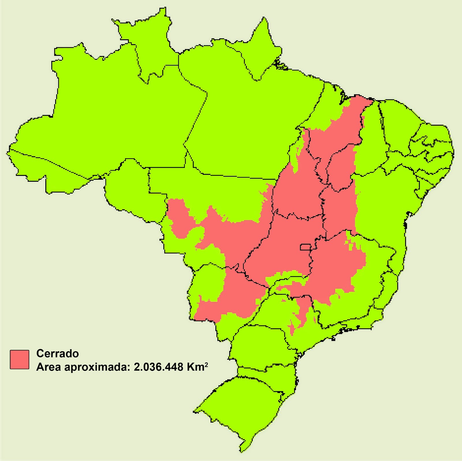
Half of it is grown in the Brazilian cerrado, a savannah-like region, where the commodity has advanced over 16.8 million hectares since the 1980s – a known threat to the rich original landscape.
In the Amazon, on the other hand, the analysis concludes that the growth of soy started in the early 2000s and added 5.2 million hectares.
The recent advance over native vegetation can be observed in the lavrado – an area with cerrado characteristics that exists within the biome in the state of Roraima. Another 26% of the country’s soy area is in the Atlantic Forest, where soy expanded by 7.9 million hectares between 1985 and 2020.
In the cerrado, the study states that almost half of all Brazil’s agriculture is concentrated: 42%. In the 35 years taken into account in the study, the Brazilian cerrado saw a 464% growth in agricultural activity.
For Moisés Salgado, the technical coordinator of Mapbiomas and technology coordinator of Agrosatélite, who participated in the research, it is necessary to focus on the conservation of native areas, which have not yet been exploited, especially in the cerrado.
“Generally speaking, what can be noticed in all biomes is that there is no need to convert natural vegetation into arable areas because there is already sufficient open land with agricultural potential, and the Cerrado is no exception,” Salgado commented.
Except for the Amazon and the Atlantic Forest, the other biomes have few demarcated conservation units, hindering landscape recovery. This reinforces the need to conserve the remaining areas of native vegetation, especially the cerrado, which has already lost half of its original coverage.
The study also considers that other surveys show that the cerrado, the biome with the most significant growth in agriculture and the most extensive area dedicated to this activity, is also one of the most fragile to changes in rainfall caused by deforestation Amazon.
The data show that the cerrado is also one of the regions with the highest climate risk. In the latest report of the Intergovernmental Panel on Climate Change (IPCC) of the United Nations Organization (UNO), there is a forecast of a 20% reduction in rainfall in the central area of Brazil, with an increase of 4 degrees to 5 degrees in temperature. This scenario, researchers believe, will still compromise the current agricultural activities in the region.
Within the Cerrado, the dynamics of land occupation vary between the states with more extended consolidated areas and the Matopiba, of more recent occupation.
On the border between the states of Maranhão, Tocantins, Piauí, and Bahia, the advance of agriculture over native vegetation is more intense, between 2000 and 2020, considering 5-year intervals, 76% of the expansion of agriculture in the region took place over native vegetation; in the other states of the biome, this percentage is less than 10% considering the same period.
The evolution of the irrigated area in Brazil is also included in the map, which shows a growth of 293%, from 819,000 hectares in 1985 to 3,217,000 hectares in 2020. The area irrigated by central pivots, which accounted for only 8.5% of the total irrigated area in 1985, accounts for 45.7% in 2020.
Since the early 1990s, researchers say, Brazil has lost 15% of its water surface. In this period, the country’s water surface had a retraction of 3.1 million hectares. The watersheds with the highest rate of water use by central pivots are Paracatu (MG), Alto São Francisco (BA), and Alto Paranapanema (SP), the three with shrinking water surface area in the last three decades.
Moisés Salgado reinforces that this type of practice runs up against the water crisis the country is going through.
“Although irrigation is the alternative for the farmer when there is water deficiency, it is not authorized in cases of crisis, like the one the country is facing now. The tendency is for water to decrease in Brazil, so the more conservative use of water in agriculture is fundamental for the future success of the activity,” he pondered.
The MapBiomas survey also shows that, in the case of sugar cane, the mapped area grew by 291% between 1985 and 2020, when this crop occupied 9 million hectares.
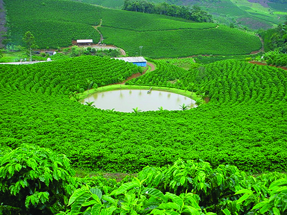
The coffee areas were mapped in the states with the largest planted areas, such as Minas Gerais, Espírito Santo, São Paulo, Bahia, Paraná and Goiás. In total, the satellite images showed that there was a 43% growth in the mapped area over the last three decades, reaching 804,000 hectares in 2020.
Regarding citrus cultivation, the survey done in the state of São Paulo shows 31,000 hectares in 2020. Forestry, which had a five times growth in the area mapped, went from 1.4 million hectares in 1985 to 7.5 million hectares in 2020. The states with the largest mapped site, according to the survey, are Minas Gerais, Paraná, and Santa Catarina.