RIO DE JANEIRO, BRAZIL – Coats will not return to closets in August. Despite the rise in temperatures in this first week, weather forecasts expect the arrival of new cold fronts that will bring temperatures down again throughout the month.
The good news is that the new cold waves will be milder than the last polar air mass that caused below-zero (Celsius) temperatures, frost on crops and snow in many parts of the South region.
According to Mamedes Luiz Melo, meteorologist at INMET (National Institute of Meteorology), the new cold fronts will be interspersed and should hit the country between August 10 and 13, and then from August 19.
“The South region and part of the Midwest and Southeast will feel chillier with these new cold fronts,” the meteorologist says. “Frost should occur, temperatures near 0ºC, but nothing like the last polar air mass.”
According to Climatempo, August will feel like “the cold won’t go away,” because the temperatures forecast for the month, particularly in the regions to be more affected by the cold fronts, will remain well below the standard for this time of year.
Climatempo also signals, as does INMET, that there is no forecast of a new cold spell similar to the last days of July, “but the cold will be longer lasting.”
For Climatempo, residents in the South region, in the states of São Paulo and Rio de Janeiro, in the south of Minas Gerais, in Mato Grosso do Sul, in the east of Mato Grosso, in Rondônia, Acre and part of Amazonas will feel colder this month.
However, for people living between the north of Minas Gerais and a large part of the Northeast, the forecast is for plenty of sunshine, with above average temperatures, according to the meteorological agencies.
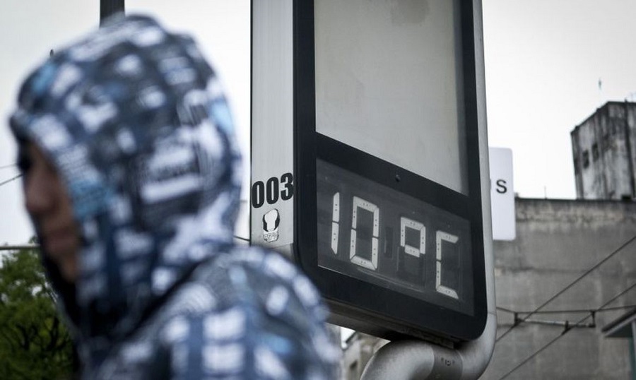
This feeling that the cold will not go away has already been observed by São Paulo residents throughout this week. In the country’s largest city, the CGE (Center for Management of Climatic Emergencies) forecasts chilly mornings at around 13ºC until Saturday, August 7.
“The trend is for a more prolonged sequence of cold days, which should last until the end of the first week of August. During this time, we will experience the year’s lowest lows and highs, in addition to a more intense cold sensation caused by the action of the wind,” CGE’s meteorologist Thomaz Garcia said.
In addition to the cold, the month will be rainy in some regions of the country. In the North region, the largest accumulations of rain will be concentrated in the northwest of Pará, Amazonas and eastern Roraima until the 9th.
Between August 10 and 18, INMET forecasts more significant rainfall in areas of the North, Northeast and South regions. In the Midwest region, areas to the south of Mato Grosso do Sul stand out.
In the Southeast, where the water reservoirs are in a state of alert, no significant volumes of rain are forecast for the month, also according to INMET.
WEATHER FORECAST IN AUGUST, BY REGION
SOUTH
A cold front should hit the region in the second week of the month. Most of the rain will be restricted to the interior of Rio Grande do Sul and Santa Catarina. At the start of the second half of the month, a mass of cold air will lead to a sharp drop in temperature, with risk for widespread frosts in Rio Grande do Sul, Santa Catarina and the interior of Paraná. The lowest temperatures are expected to be registered between August 15 and 20.
SOUTHEAST
In the second week of August, a cold front will hit the region and bring temperatures down and mild to moderate rainfall in the coastal regions of the states of São Paulo and Rio de Janeiro. Between August 17 and 19, another cold front is expected to reach the region, causing the temperature to drop in the four states. The cold will last longer and the temperature will only rise again in the last week of the month.
MIDWEST
Two cold fronts will reach the region in the first half of August, one in each week, causing low temperatures between Mato Grosso do Sul and Mato Grosso, including the two states’ capitals. At the start of the second half of the month, a more intense cold front will cause frost and the occurrence of rainfall in places where rain is uncommon this month.
NORTHEAST
With more sunny days and little clouds, the temperature will rise in relation to the previous month, albeit mildly. The temperature should remain quite stable and extreme cold or heat events are not expected.
NORTH
The rain decreases in intensity in relation to the previous month and the temperature remains stable in most of the region. Between Manaus and Belém, rain should still persist frequently, preventing the temperature from rising. Between Rondônia, Acre and the south of Amazonas, two cold snap events are expected during the month.
Source: Climatempo