By Eduardo Vessoni
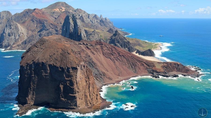
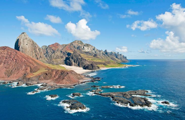
A four-day journey from the mainland and 1,140 kilometers off the coast of Vitória, in Espírito Santo, underwater mountains emerge 5,500 meters from the ocean like volcanic castles, surrounded by inaccessible islets.
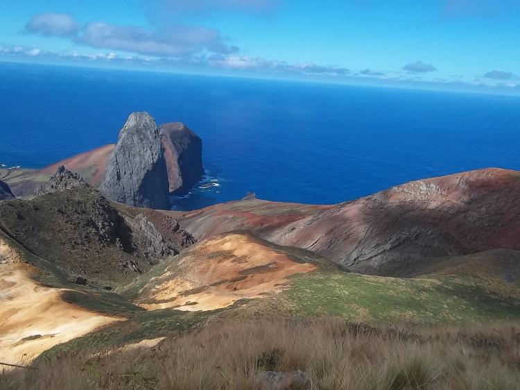
There are 16 isolated beaches, with a temperature that varies between 21°C and 27°C and surroundings covered by giant ferns up to six meters high.
It’s all very beautiful, but you won’t be able to visit this archipelago with two main islands, Trindade and Martim Vaz.
Unless you are a member of the Armed Forces or one of the researchers who spend time at the Trindade scientific station, opened in 2011 with a balcony, living room, kitchen, bathrooms and two bedrooms for 4 people each.
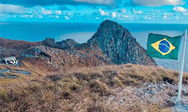
There are two pieces of Brazil that are very difficult to access: while Trindade is the most remote inhabited place in Brazil, Martim Vaz is the most eastern point of the Brazilian territory, 48 kilometers away from the first.
DEADLY AND UNEXPECTED WAVES
One of the greatest fears of the few visitors who disembark in Trindade is the so-called “camel wave”, a natural phenomenon that forms unexpectedly and arrives at the edge of the beach with extreme violence.
According to scholars, this is an unexpected formation of waves of more than two meters “which, when reaching shallow waters, suffer an abrupt increase in height” and return to the sea with even more violence due to the sloping terrain of the island.
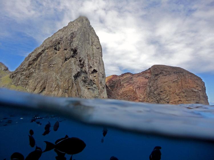
Therefore, fishing, diving and bathing in the sea are highly risky activities.
Since 1963, seven fatal cases have been recorded, like the one in 2010, when a sergeant was dragged by a “camel wave” during a trail in Praia do Príncipe. His body would not be found until two days later.
According to Protrindade, a scientific research program on the island, the wave gets its name because it resembles a camel hump.
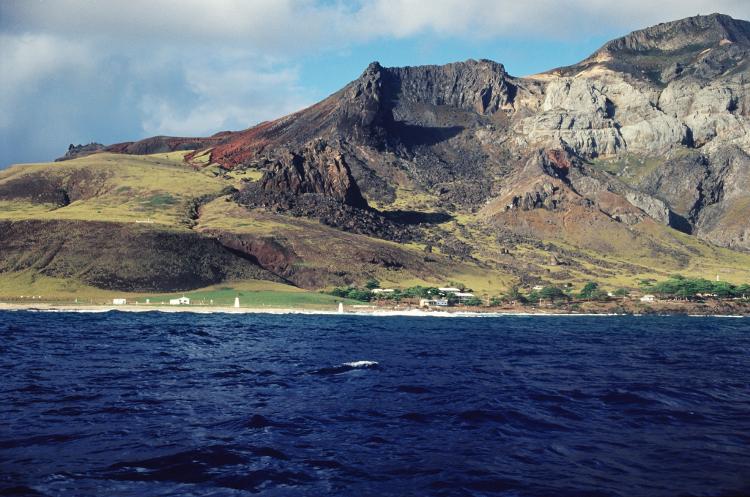
With an extremely rugged terrain, Trindade has about 10 square kilometers and its access is made by inflatable boats that are pulled by steel cables that are on the beach.
However, not all these difficulties were able to keep the island intact from invaders.
PIRATES, SCIENTISTS AND OTHER DISTINGUISHED VISITORS
Its strategic location, in the center of the South Atlantic, is responsible for several international disputes, since it was discovered in the beginning of the 16th century.
In the following centuries, the region would be used as a stopover for English pirates and traffickers of enslaved workers. Even the British astronomer Edmond Halley, the one behind the comet, was there when the first landing was made in Trindade, in 1700.
In fact, legend has it that it was he who would have taken the goats from distant Saint Helena that would have destroyed the vegetation of Trindade. The regeneration of the fauna would only take place in the 1990s, when the animals were shot.
Impressed by the brutality of Trindade’s geography, the navigator James Cook was also on the island, in 1775.
For years, Trindade was confused with Ascension Island, a British overseas territory, whose closest piece of land is the also isolated Saint Helena, the Napoleon Bonaparte’s last refuge.
Throughout history, Trindade would also be occupied by the Portuguese and the English. But, according to the Brazilian Navy, it would only be incorporated as a national territory, after the proclamation of independence in 1822.
Under British rule, the island would be claimed by Brazil, again, from 1895, when the British occupied Trindade with the justification of “establishing a submarine cable station connecting England and Argentina.”
Trindade also served as a strategic stop and left its mark on the route of the “Worst Voyage in the World”, as reported by Apsley Cherry-Garrard, one of the 65 crew members of the Terra Nova Expedition (1910-13), led by the English explorer Robert Falcon Scott, who was trying to be the first to reach the South Pole.
During the two world wars, in 1916 and 1941, Trindade was also occupied by Brazilians, in order to protect the region from enemy ships.
AMAZON ON THE HIGH SEAS
Currently, the islands of Trindade and Martim Vaz are part of the Blue Amazon, a maritime territory of about 3.6 million square kilometers that is named in reference to the abundance of natural resources, as in the largest tropical forest in the world.
For this reason, access is restricted to researchers and military personnel, as well as in the archipelago of São Pedro and São Paulo, and in Atol das Rocas.
In 2018, the two archipelagos (Trindade and Martim Vaz and São Pedro and São Paulo) were declared federal marine conservation units, giving rise to two APAs (Environmental Protection Area) with more than 90 million hectares.
Earlier this year, for example, Martim Vaz attended an unprecedented expedition that became known as “the first scientific camp in the island’s history.”
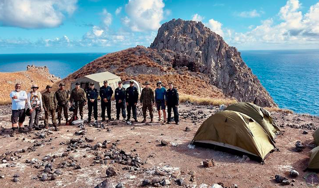
Aboard the Hydroceanographic Ship “Almirante Graça Aranha”, 117 professionals landed on the island for studies in the areas of oceanography, geology, history and environment, in partnership with the federal universities of Rio de Janeiro and Rio Grande do Sul, and UERJ (University of the State of Rio de Janeiro).
Trindade, on the other hand, occupied by the Brazilian Navy, uninterruptedly, since 1957, has scientific activities since then, when it started to operate the POIT (Oceanographic Post of Trindade Island), managed by about 30 military personnel who take turns every 4 months.
“[The Navy is] responsible for guaranteeing the presence of the Brazilian State in that distant portion of our territory and the sea that surrounds it”, describes the institution in a note.
This is the only point in the entire region with permanent occupation, where the military and researchers must continue to be the only humans to reach this part of Brazil that seems to be outside their own country.
With information from UOL