By Paulliny Tort*
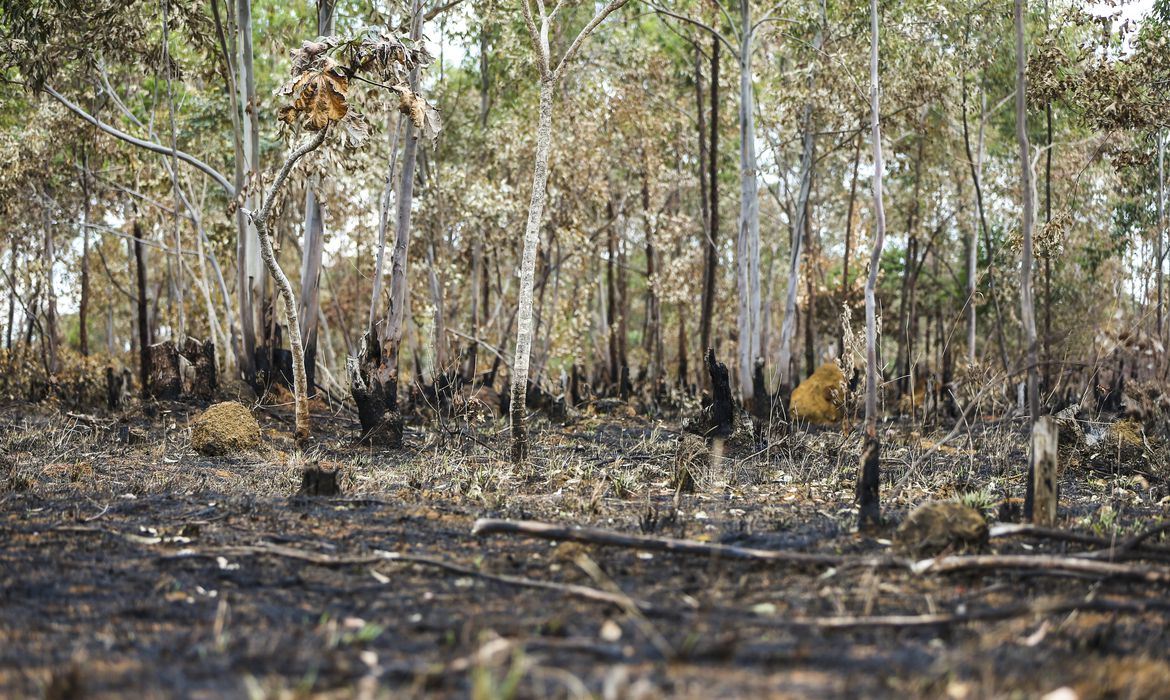
In 38 years, Brazil burned 185.7 million hectares, an area equivalent to the territories of Colombia and Chile together, or 21.8% of the national territory.
This is what MapBiomas Fogo data reveals, mapping that counted the extension consumed by flames between 1985 and 2022 based on satellite images.
“With this historical series of fire data, we can understand the effect of climate and human action on wildfires and forest fires,” says Ane Alencar, coordinator of MapBiomas Fogo and director of Science at the Instituto de Pesquisa Ambiental da Amazônia (IPAM) [Amazon Environmental Research Institute].
Using images generated by three Landsat satellites, fire action was tracked in all types of land use and land cover in Brazilian territory.
According to the results, the Cerrado and the Amazon were the most affected biomes, corresponding to about 86% of the burned area.
The Cerrado burned an average of 7.9 million hectares/year, or an area equivalent to the territory of Scotland each year.
In the case of the Amazon, the average was 6.8 million hectares/year.
When the proportions of the affected areas within the biomes are analyzed, the Pantanal was most affected: 51% of its territory was consumed by fire in this period.
COVER IMPACTED BY FIRE
According to the analysis, more than two-thirds (68.9%) of the burnings and fires occurred in native vegetation, although the proportion varies between biomes.
Fields and savannas, for example, are the most affected types of native vegetation.
At the same time, the Amazon and Atlantic Forests showed a higher incidence of fire in anthropic areas, that is, areas altered by humans, such as pasture zones.
Mato Grosso was the state that presented the highest occurrence of fire in the analyzed period, followed by Pará and Maranhão.
The municipalities that burned the most in the country were Corumbá (MS), São Félix do Xingu (PA), and Formosa do Rio Preto (BA).
According to Ane, fire is not always undesirable.
“Fire is only bad when used inappropriately and in biomes that do not depend on fire to maintain themselves, such as the Amazon.”
“In biomes like the Cerrado, the Pantanal, and the Pampa, fire has an ecological role and must be managed correctly to avoid becoming an agent of destruction,” explains the specialist.
FREQUENCY AND INTENSITY
Although it is natural in some ecosystems, data shows that the frequency and intensity of fire have increased in recent years due to deforestation and climate change, which affects temperatures and intensifies drought periods.
“For this, practices related to Integrated Fire Management (IFM) are important because they can, through prescribed and controlled burning, reduce the amount of combustible material and avoid large fires,” says Ane.
The complete mapping data can be accessed for free on the MapBiomas platform, bringing universities, NGOs, and technology companies together.
The study also makes available clippings by frequency, biome, state, municipality, watershed, conservation unit, indigenous land, settlements, and areas with Rural Environmental Registry (CAR).
This registry is a mandatory public record for all rural properties and gathers information for environmental and economic planning to combat deforestation.
*Edition Heloisa Cristaldo
With information from Agência Brasil