RIO DE JANEIRO, BRAZIL – Close to 800,000 hectares (around 3,000 square miles) have burned, while experts and specialists fear a repeat of the devastation of past years. In 2019, the fires destroyed nearly 6 million hectares, while in 2020 the figure reached 4 million.
On Friday, August 27, Yovenka Rosado, head of the Forest Fire Unit of the Santa Cruz governor’s office, said that fires have consumed 786,584 hectares to date in the department of Santa Cruz alone.
In the past month it has been the most affected department, where large forest fires have been registered in its protected natural areas. The San Matías Integrated Management Natural Area (ANMI), the Ñembi Guasu Ecologically Relevant Conservation Area and the recently created Bajo Paraguá San Ignacio de Velasco Municipal Protected Area are some of the devastated sites.
“In the last two weeks the fire outbreaks intensified and became fires of great magnitude,” says Miguel Vargas, executive director of the Center for Legal Studies and Social Research (CEJIS), an institution that conducts satellite monitoring. “The fire grew in the Chaco and the Chiquitania,” Vargas adds about the ecosystems that are being most impacted this year.
DEVASTATION IN NATURAL PROTECTED AREAS
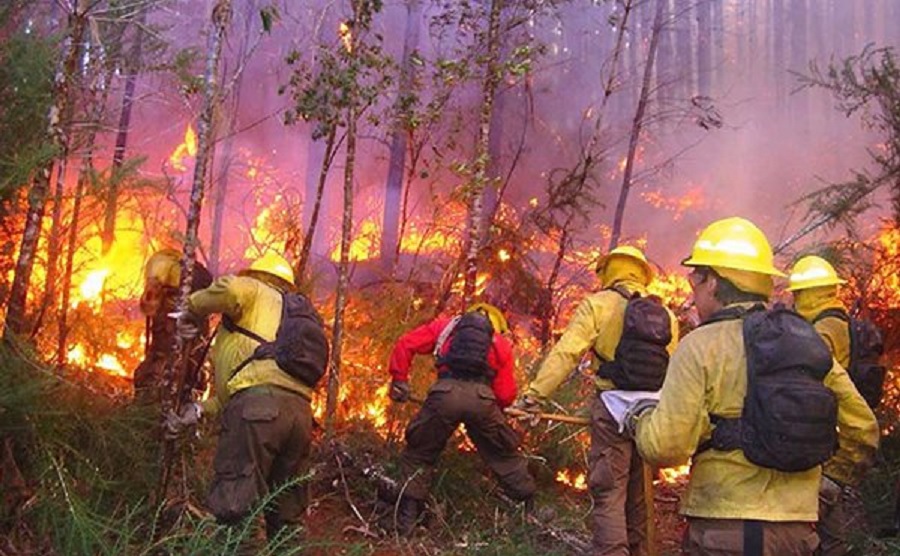
The first days of August saw the start of devastation in the San Matías NMA, where, in just one week, around 100,000 hectares were reportedly destroyed by fire. The rapid advance of the fire, favored by weather conditions, prevented its quick control.
The forests of San Matías burned for weeks and it was not until the last week of August that rainfall and the firefighters’ efforts brought the fire under control.
The latest report from the Chiquitano Dry Forest Observatory indicated that by August 22, 231,864 hectares had burned within the San Matías protected area, according to satellite images. If the region outside of the protected area is considered, the figure rises to 306,837 hectares.
“Once again we are facing the problem of mega-fires. Under these climatic conditions, with prolonged drought, we are dealing with a new catastrophe,” says Oswaldo Maillard, coordinator of the Chiquitano Dry Forest Observatory of the Foundation for the Conservation of the Chiquitano Forest (FCBC). “San Matias has been active for more than a month. Otuquis is burning again. And there is a mega-fire in Ñembi Guasu,” he adds.
The Chiquitano Dry Forest Observatory also reported fires in the municipalities of Charagua, where it registered 78,936 hectares burned; in San José with 48,642 hectares destroyed and in Roboré with 24,583 hectares destroyed by fire.
The situation has been devastating in the Ñembi Guasu protected area, where, according to the Dry Chiquitano Forest Observatory, 87,703 hectares of forest had been lost by August 22.
However, the fire raged on in the following days so a greater amount of forest loss is expected as a result.
“In Ñembi Guasu there have been several fronts where fires have occurred. One began in July and another around August 14, the largest,” said Juan de Dios Garay, a biologist with the organization Naturaleza Tierra y Vida (Nativa), after a tour of the destroyed protected area. “We have seen rodents, reptiles, and mammals of all kinds dead on the road,” he adds.
Garay indicates that it is very difficult for any species to survive in these fires, and that those that manage to escape the fire reach the burned areas where they cannot even find water.
“We have found areas that have virtually become a sandy area, even sand dunes have formed in those places,” Garay adds about how the reserve is being transformed.
In addition to San Matías and Ñembi Guasu, five other protected areas have been affected by the fires: the Otuquis National Park and Integrated Management Natural Area; the Tucabaca protected area in Roboré; Laguna Concepción in Pailón; Orquídeas del Encanto in Concepción; and the Bajo Paraguá Municipal Protected Area.
The hope that the fires can be controlled came with the rains of last weekend. According to Rosado, in the municipalities of Roboré, San José, Charagua and Puerto Suárez – in Santa Cruz – the fires have been brought under control. However, in the places the rain has not reached, there are still fire outbreaks.
BEYOND BORDERS
Forest fires in Bolivia have crossed borders and spread to Paraguay. José Luis Cartes, director of Guyra Paraguay, notes that the fires that spread from Bolivia have affected the Paraguayan Pantanal Reserve and the Los Tres Gigantes Station. “In a single night, the forest fire covered 25 kilometers in these reserved areas,” Cartes says.
However, rainfall on Friday, August 26, slowed the fire that had been active for at least 4 days. Cartes recalls 2019 when the fires lasted until November. “Everything burned very quickly,” he says.
This time, Guyra Paraguay is working with the Nativa Foundation to “conserve the most extensive natural protected areas in both countries,” Cartes adds.
Ivan Arnold, director of Nativa, points out that the fire that broke out in the north of Ñembi Guasu crossed the reserve to the south and spread into Paraguay. And although recent rains have helped contain its spread, Arnold still fears what may happen in the coming months, which, he says, are the most critical. “We are still highly vulnerable. The problem is the people who set fire.”
CEJIS’ director Miguel Vargas also refers to the problem of “chaqueo” or patch burning in Bolivia – the practice of setting fire to vegetation to prepare the land for crops – which has become the main cause of forest fires in the country.
“The package of regulations that allows the clearing of areas of permanent forest production in order to enable them for monoculture production is still in force,” Vargas adds.
The CEJIS director is referring to a set of laws and decrees issued in the past 15 years that have allowed patch burning and land use change in forest territories. “It is a recurring situation, every year at this time: July, August and September we see the forest burning,” he concludes.